Category Archives: Wilderness

Te Araroa Packing List
.
Let me confess that I am not an ultralight backpacker. Or that I even concern myself much with the weight I carry in my pack. When on a camping trip, I like having all the various comforts and amenities along with me, and no matter how heavy my pack is I still find a way to carry it. My tendency to overpack is not helped by owning a 100-liter pack that, no matter the length of the trip, I somehow always find a way to stuff full.
Ultralight backpackers, on the other hand, become obsessed with ounces. Experienced ultralighters can get the base weight of their gear down to 15 pounds or less. They find myriad creative ways to reduce weight, like cutting off the handle of their toothbrush or using a tent-stake as an eating utensil instead of packing a spoon. Yuck! Personally, I don’t mind carrying the extra ounce to have a spoon that is solely reserved for eating.
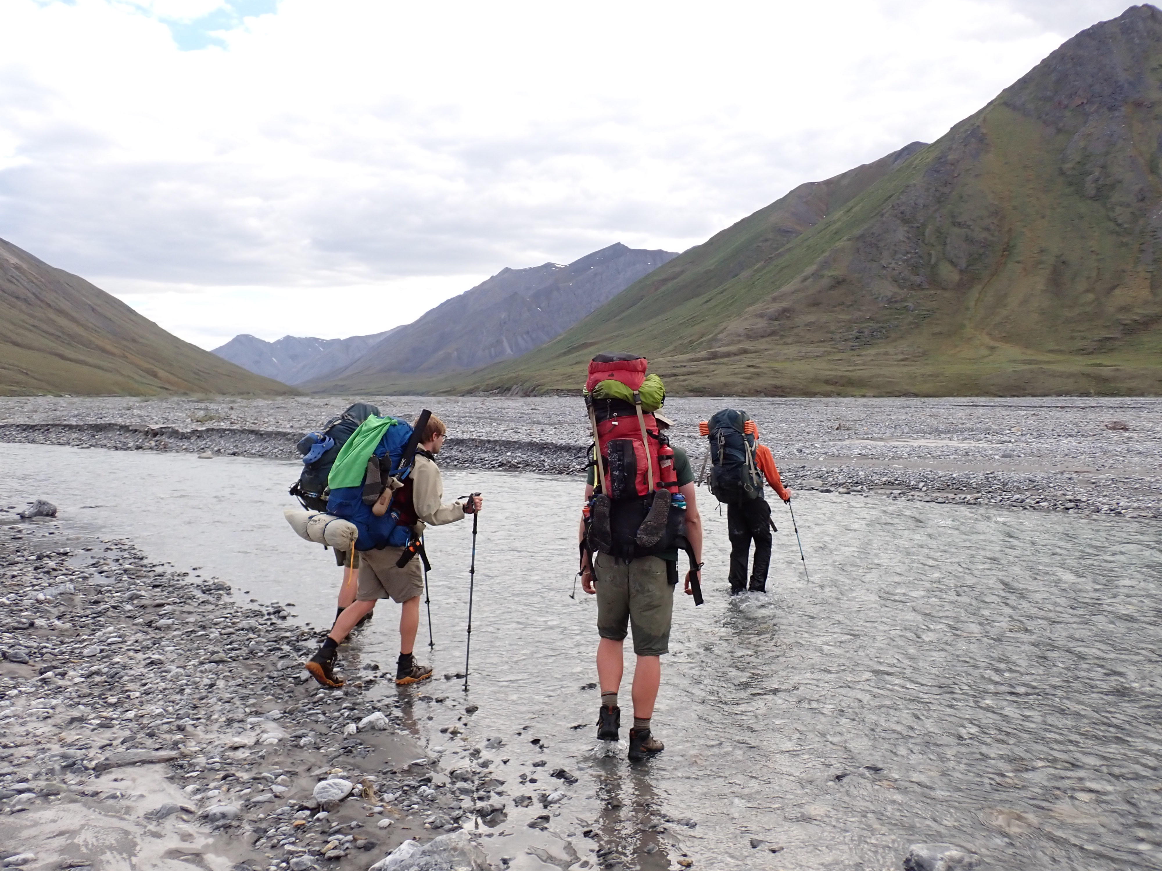
The bulk of my backpacking experience comes from working as a trail guide at YMCA Camp Menogyn, which, with its emphasis on extended backcountry expeditions for youth, is concerned more with carrying all the necessary gear for an expedition and is less concerned about how much all of it weighs. Menogyn is not an ultralighting outfit in any sense of the word. This past summer, I led the longest backpacking trip that Camp Menogyn offers for its participants, a 40-day excursion to Alaska’s Arctic National Wildlife Refuge (ANWR). My 100-liter pack’s base-weight was somewhere around 40 pounds. Add in shared group gear and provisions for two weeks at a time, and my pack could weigh as much as 70 to 80 pounds—or more! Aside from weigh-ins for our bush plane flight, we weren’t too concerned about how heavy our packs were. All we really knew was that they were heavy!
Backcountry camping Menogyn-style, we needed to carry all that we could envision needing for forty days in the wilderness—repair kit, first-aid kit, extra food rations. Gear breaks and needs to get fixed, the food resupply plane might not arrive on time due to weather, and we needed ample first-aid kit supplies for anything upwards of a grizzly bear attack. Backcountry camping is about carrying enough supplies and knowing how to use them to prepare for every eventuality. But of course, it’s not just all about the necessities either. My group carried, for our entertainment, the luxury of a frisbee and plenty of books as well. And no, none of us ripped apart and burned the pages of our books as we read them—not even David Foster Wallace’s 1,079-page tome Infinite Jest. My reading on this trip included a book about two authors/filmmakers who spent five months in the Canadian and Alaskan Arctic following caribou—though their packs weighed upwards of 100 pounds with camera gear and provisions, they still found the wherewithal to pack a George W. Bush doll so that President Bush could too see the Arctic (cue the video in the link to 3:45 to see the Bush doll’s cameo).
As I transition from an extended backcountry expedition in Alaska to a thru-hike of New Zealand’s Te Araroa trail, I’ll be encountering a very different style of backpacking than I’m used to and have been trained on. So different in fact, that I might as well be starting from scratch! Aside from a lot of the gear looking similar, not much of the practice of travel is the same.
Backcountry camping, like I am accustomed to, is about spending a significant portion of time in federally-designated wildernesses, or areas with little human influence. Thru-hikes, which include more famous trails such as the Appalachian Trail and the Pacific Crest Trail as well as Te Araroa, also pass through many wildlands—but include lots of contact with the developed world as well; in the case of Te Araroa, the trail passes directly through New Zealand’s two largest cities, cuts through miles of sheep pasture (it is New Zealand, after all), and is around 15 percent hiking on roadways.
Another large difference is that backcountry camping does not necessitate hiking a large number of miles each day. In ANWR, our group averaged just four miles of ‘progress’ each day towards our end point of the Dalton Highway. This relaxed schedule allowed us to be free to set out on day-hikes and wander more or less where our hearts desired within the Refuge. In fact, Arctic National Wildlife Refuge has no designated hiking trails. On Te Araroa, the objective will be to get from Point A—Cape Reinga, the northernmost tip of New Zealand’s North Island—to Point B—the city of Bluff, the southernmost tip of the South Island. I will be following closely the trail of Te Araroa the whole time—hopefully not head-down looking at my feet constantly, but looking about and enjoying the scenery. But ultimately follow the trail I will, and the daily goal will be to put on the miles to complete the trail in an ever-shrinking time window (my hiking partner Annemarie has a firm deadline to return to work at McMurdo Station, Antarctica, and I last-minute delayed my start on the trail by about two weeks when an opportunity popped up the night before my departure). With 2,000 miles to cover, and potentially only 3 ½ months to do it in, we could be faced with hiking an average of 19 miles a day. Woof!
Finally, the difference in the food. In ANWR, my trailmates and I carried so much food on our backs—up to 15-days’ worth—because we could only get resupplied only so often by bush plane. In order to carry that many meals, our food needed to be dehydrated, and all 40 days’ worth of food was packed well ahead of the trip itself. Given the amount of time that our dehydrated trail food spent sitting in thin plastic bags all squished together, it is no surprise that all our provisions tended to meld into the same generic trail-food taste. With thru-hiking, I do look at food as being an upside. While the South Island of New Zealand does have several long sections between towns, the number of miles we will cover each day will allow for more frequent resupplies of our provisions. And also the chance to eat at restaurants and fast food! Indeed, my perception of thru-hiker victuals is hiking all day long just to eat at the next McDonalds.
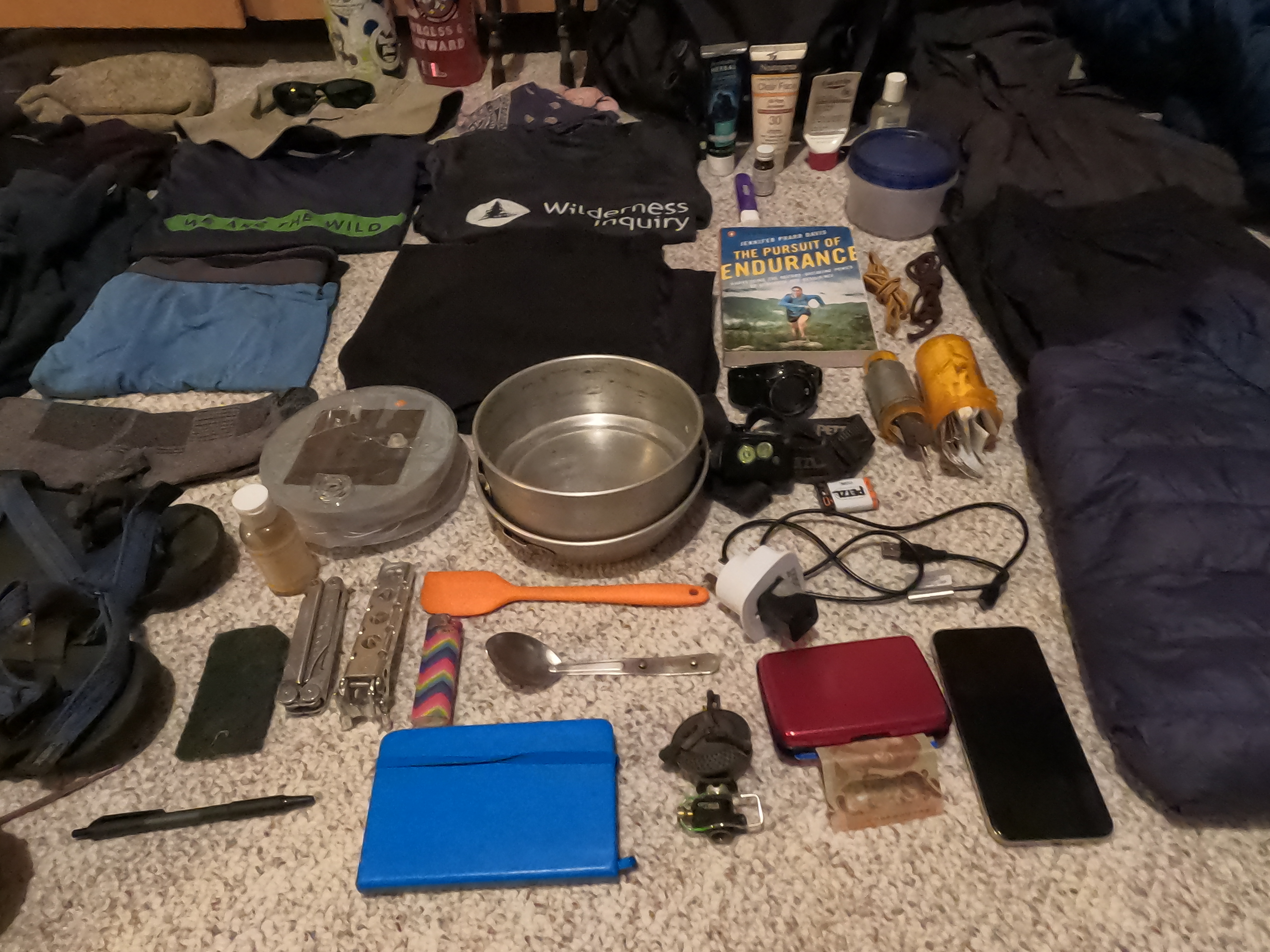
With all this in mind, here’s what I currently have planned to take on Te Araroa. I did myself a favor by downsizing to a 65-liter pack so that I can’t stuff it too full. Currently I have my base weight down to just under 30 pounds. How much of this stuff I will still be carrying at the end of the trail will be a guessing-game over the next 2,000 miles. I included brand names and trade names just to be specific about the gear I have, but recommend finding whatever works best for you, whether brand name or not. I myself have little brand loyalty and have amassed my outdoor gear collection via Craigslist, the REI® Garage Sale™, and discount sections at outdoor gear stores.
.

.
Backpacking and Sleeping Gear
- Osprey® Rook™ 65-Liter Backpack
- Mountainsmith® trekking poles
- REI® Zephyr™ 25⁰ synthetic sleeping bag
- Sea to Summit® Thermolite™ sleeping bag liner (+10⁰)
- Nemo® Tensor™ inflatable sleeping pad
- The North Face® Asylum Bivy™ single person tent
Clothes
- Hiking Clothes
- 1 sunhat1 pair sunglasses1 synthetic shirt1 Original Bug Shirt Company® bug shirt1 pair synthetic underwear1 pair trail running shorts1 pair synthetic socks1 pair La Sportiva® Bushide™ trail running shoes1 cotton handkerchief1 rain jacket
- 1 pair rainpants
- Non-hiking clothes
- 1 synthetic shirt1 lightweight fleece1 medium weight fleece1 puffy jacket1 pair synthetic underwear1 pair synthetic convertible pants/shorts1 cotton handkerchief1 pair lightweight gloves1 beanie1 pair Xero® sandals1 pack-towel
- 1 pair synthetic socks
.
.
Cook-Kit
- Optimus® Crux™ stove with case (uses isobutane/propane fuel available in New Zealand)
- 1 2-liter aluminum cookpot
- 1 potgrips
- 1 spoon
- 1 rubber spatula
- 1 Leatherman® multi-tool
- 1 plastic tupperware
- 1 lighter
- 1 small bottle Dr. Bronner’s® biodegradable soap
- 1 small green Scotch-Brite™ pad
- 1 bottle Potable Aqua® iodine tablets (50-count)
- 1 stuff-sack for carrying food
- 2 32-oz Nalgene® water bottles
Toiletries
- Small tube of toothpaste
- 1 travel toothbrush
- Small tube of sunscreen
- Small tube of hand lotion
- Small bottle of hand sanitizer
- 1 small first-aid kit in an old pill bottle
- Moleskin®Assorted small bandages1 roll athletic tapeAnti-biotic ointmentDiotame anti-diarrheal tabletsIbuprofenHydrocortisone creamSmall and large nail clippers
- Tweezers
Electronics
- Petzl® Actik™ headlamp with rechargeable battery
- Luci® Base™ solar charging lantern
- New Zealand wall outlet adapter
- American charging block
- Charging cord compatible for all electronics
- Smartphone (to use for photos, staying in contact, and navigation apps for the Te Araroa)
- Wristwatch
Extras
- 1 Repair Kit (fitting inside old pill bottle)
- Gear repair tapeInflatable sleeping pad patchesThin sewing threadThick waxed sewing threadAssorted sewing needlesSafety pinsZip tiesDuct tape wrapped around pill bottle
- 2 spare shoelaces
- Journal
- Pen
- Book (Jennifer Pharr Davis’s The Pursuit of Endurance. Why not start off with a book on running the Appalachian Trail?)
- Aluminum wallet with ID, New Zealand cash, and credit cards
.
Happy Trails!
.
.

Chasing Light

It seems I’ve been chasing light lately. First an Austral Summer below the Antarctic Circle. Then a Boreal summer above the Arctic circle. In a few day’s time, shortly after the autumnal equinox has ushered in fall to the northern hemisphere, I will board a plane and fly back to the southern hemisphere for the start of spring. I seem to have become a season hopper.
With three summers in a row without a winter season in between, you’d be forgiven if you thought I was chasing warmth and sunshine instead of chasing daylight. Though astronomically speaking, the seasons have been summer, traditional ‘summer’ weather has been neither what I was seeking or have experienced. Last December I spent the solstice in Antarctica, though even the peak of summer there felt climactically akin to my brethren at home in the Midwest. This June, I was in northern Alaska for the solstice. Yes, temperatures could rise and be unbearable under the full, circling, blazing sun—but it could also become cloudy and reach temperatures within the range of snowfall. Indeed, though the daylight has indicated summertime, these summer seasons haven’t always seemed particularly ‘summery.’
And here I go again, back to New Zealand, back to the southern hemisphere, and back into another summer season. It wasn’t by design that this happened—circumstances and the development of life decisions just produced this unintended result. While working in Antarctica last October through February, I met someone who convinced me to join her on a thru-hike on New Zealand’s Te Araroa trail. So, while the days are short and the snow falls in the northern hemisphere, I will be on the other side of the globe chasing the warmth and summer season as we hike the island together. As we follow the trail from north to south, we will be reaching higher and higher latitudes where in summer the days become longer and the nights are short.
In the temperate mid-latitudes where New Zealand lies, the distinction between periods of night and day are pronounced, but not extreme. But life, as well as the landscape, reaches towards the extreme the more one goes poleward. And beyond the Arctic and Antarctic circles, the land goes from 24-hour sunlight in the summer to 24-hour darkness in the winter. The polar regions are places of extreme seasonal differences. The summer season knows not the winter season, and the transition between the two is abrupt with only truncated springs and falls. From the sun circling overhead continually in the summer, there is only a short transition until the suns sets and never peaks above the horizon in winter.
I have seen firsthand the way the sun wanders aimlessly around the polar summer sky, circumambulating. At McMurdo Station, Antarctica, 77.5 degrees south, I spent 118 days without a sunset. When it finally did occur, the first sunset of the fall was a momentous occasion. The residents of McMurdo piled outside to watch as their faithful sun companion dipped briefly below the horizon, only to rise less than an hour later. And though the sun had officially set, it was far from night, and would be for quite some time. In the beginning of fall, the sun stays so close to the horizon that it remains civil twilight for hours after sunset. Not until a month and a half after the first sunset of the fall does McMurdo experience its first true minutes of night.

With traditional distinctions between day and night becoming muddled at the poles, day and night become somewhat irrelevant. How is one to tell the passage of time when one cannot tell when one day slips into the next? In summer, the sky remains constantly lit. Day rolled into night, but the night seemed just like the day.
In Antarctica, during the summer season, I ended up working the night shift at McMurdo Station. Though the 24-hour clock that the research station ran on considered the shift to be ‘nighttime’, there was no darkness. The only indicator of night was that the throngs of researchers and science support staff hanging out in the galley would slowly subside; there would be a few hours of peaceful quiet while the station slept, until folks began to roll into the galley for coffee and breakfast at the start of another workday. Meanwhile, in those quiet hours in the wee of the morning, the sun was at its lowest angle on the horizon, sending in radiant beams of light through the bank of galley windows—a middle of the night golden hour.
I had no problem adjusting to working the night shift after spending my first few weeks on station as a daytime worker—the sun was as bright as always, and I did not feel like I was sleeping away and wasting daylight as I had felt when I worked overnights for big-box retail. Inside my windowless McMurdo dorm room, the lights were always off. When I needed nighttime, I could retreat to my room and sleep soundly out of the sun. But were I to choose to go out and play instead, the sunlight would be my constant companion.
I had more experience living under the midnight sun this summer, as I led a 50-day backpacking trip north of the Arctic Circle to Alaska’s Arctic National Wildlife Refuge. Our latitude was not quite as high as McMurdo—only at 69 degrees latitude—thus the extremes of sunlight were not as pronounced. But what this trip to Alaska lacked in sheer latitude, it made up for in intensity of experience. Gone were the modern conveniences of McMurdo Station. There was no longer any indoors to hide in, no eternally dark dorm room or dimly-lit dark bar to retreat to. Instead, we were out in the backcountry with no more than we could carry upon our backs. Our only shelter was a thin-walled tent, and the daylight filtered right in. We either made friends with our eyemasks, or we learned to sleep in the light. Once again, the time of day became irrelevant—there was no hiding from the constant presence of the sun.
It took a number of days before I lost the nagging feeling that comes after looking at the late hour on my watch and feeling the pressure to get a hustle on to make camp before darkness falls. Throughout the duration of the trip, I kept tabs of the time on my watch—not out of necessity, but more out of a curiosity of how our circadian rhythms were adapting. Our days slowly dragged out to be longer, as we stayed up later enjoying each other’s company and slept in longer the following mornings. Thus, we ended up being awake through the darkest hours of the day, and even towards the end of the trip after the sun had been setting below the horizon, the light remained with us. Even in the depth of night on our last day in the Wildlife Refuge, it remained light enough in the tent to read a book.
In spite of the mounting fatigue from daylight that comes with constant exposure to lightness, I appreciated the daylight as a benign and amiable companion in a remote and unfamiliar terrain. Here we were, traveling for weeks in the Arctic National Wildlife Refuge, where wolves and grizzly bears roam wild. The signs of these animals were all over—tracks, scat, kill-sites. But the daylight made the wilderness seem friendlier. All told, we saw six wolves and seven grizzly bears on the trip. Seeing the bears and watching their natural disinterested movements in the daylight provided much more psychological comfort for us than wondering if out in the darkness somewhere was a bear lurking just outside the tent.
At about the same time on the trip that I began to miss the creature comforts of home—dry feet and doorways instead of tent zippers—I also began to miss the darkness. Aside from being able to sleep better in the darkness, I began to miss darkness not for darkness itself, but for what it brings to us. The constant daylight drowns out the stars all polar summer long. I’m constantly reminded that people forget this, as I am asked quite often if I saw great stars or aurora. Unfortunately, I was able to see neither stars nor aurora, much to the disappointment of my star-gazing self. And too, having the darkness creep in at the end of the day provides a natural daily cycle of gathering in your shelter for rest. Darkness too, lends itself to gathering around a campfire for light and warmth. Though we did have a campfire on the riverbank one night in Alaska, the magic of the fire just wasn’t the same in the light hours.
As much as I began to miss the darkness, when it finally did come, it felt uncomfortable and foreign. Towards the end of our trip, the nights had been gradually growing dimmer. But right after leaving the Wildlife Refuge, we caught a shuttle ride to Fairbanks, which sits below the Arctic Circle. Darkness descended upon us as we camped in Fairbanks that night. For the first time in nearly two months, it was no longer light enough outside to walk around without a headlamp. The feeling was unfamiliar. Suddenly all the scary feelings of darkness came rushing back in that gut-wrenching primordial fear of the unknown. My how easy it is to forget what darkness is like!
This coming summer, the distinction between day and night will not be as pronounced as I hike the Te Araroa as it was when I spent time closer to the poles. The mid-latitudes will provide a kinder balance of light and darkness each day. Nevertheless, as fall and winter begin to descend on the northern hemisphere, I will once again be off chasing light.

A Royal Walk: Hiking across Isle Royale
The Sun Rises Over Isle Royale
It was the middle of May 2018 when I first landed on Isle Royale. That storied island—that mass of rock isolated in northern Lake Superior. So far away it seems logically like it should be part of Canada, yet it belonged to Michigan—the only National Park in my home state. The mystery of that island beckoned me from maps with its geography and isolation. Long had I wanted to discover what this coveted gem had in store.
At long last, I finally visited the island after spending a winter and a spring teaching environmental education in northern Minnesota. By that time, I had become quite familiar with the boreal northwoods from all those hours teaching kids in the wilds. The northern forests, hence, were not all that different from my everyday existence.
Given my years of anticipation, Isle Royale was bound to be something exceptionally different than what one could experience on the mainland, I believed.
As it was, my first trip to the island was a simple, short overnight stay, ferrying in from Grand Portage, Minnesota to the Windigo Visitors Center on the western end of the island. As far as landscapes go, the flat, forested, mixed-conifer forests of Windigo are not spectacularly different than the Minnesota Northwoods I had become accustomed to.
I was a bit underwhelmed.
I didn’t even bother to take any pictures (incidentally, my camera had broken earlier that trip).

Arriving at Washington Harbor at Windigo
I left Isle Royale that trip convinced that I had seen the island in the wrong way. A simple overnight trip was no way to do the island ecosystem justice. If I was ever to return to Isle Royale, I thought, I would do it in the right way: I would hike the island from end to end, slow enough to absorb the ecological transitions, to understand the essence of what makes the place, and to enjoy immersion in the vast isolation of Isle Royale.
As chance would have it, in the summer of 2019 I was selected to take part in a volunteer restoration crew on Isle Royale’s Rock of Ages Lighthouse. I would be returning to Isle Royale sooner than I had thought, and this time, I would be staying on to hike across the island afterwards.
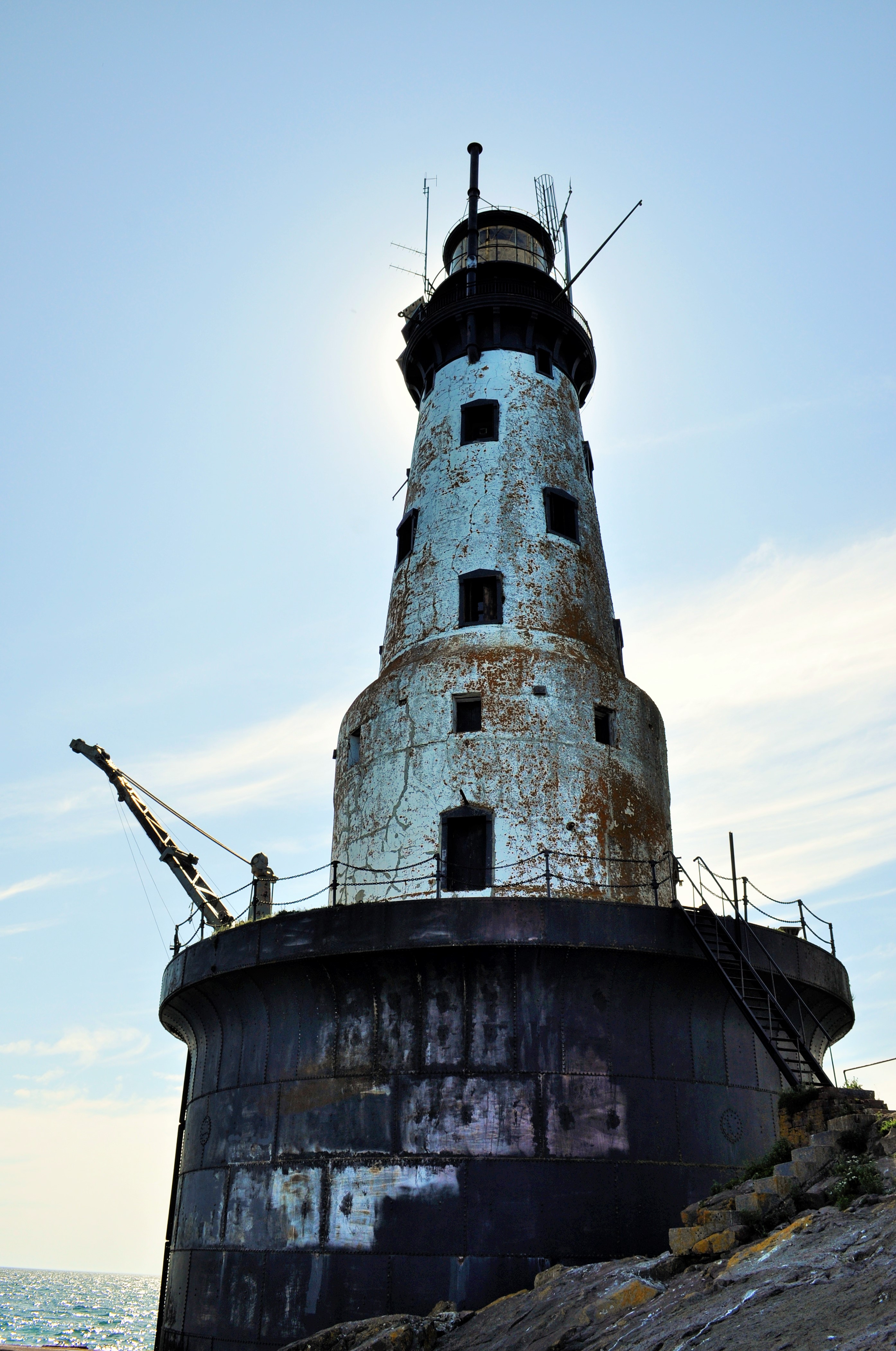
The Rock of Ages Lighthouse
I started my hike on the western end of the Island, at Windigo, the widest part of the island. Here the forest commands the land and the coastline is smoother, less jagged. I made my way to the Greenstone Ridge trail, the hiking path that transects the middle of the island. Despite its name, the Greenstone Ridge at this point isn’t much of a ridge at all. The trail slowly climbs uphill under the cover of a mixed-forest—conifers, but also maples and even the warm-and-dry loving oaks. I spent my first night at the interior campsite of Island Mine, the site of an 1870’s copper mine that peaked and was abandoned in only a few years.

Broadleaf forests found more commonly on the western end of the island
Mining history would be a big theme of the hike, and copper was the resource of value. It wasn’t just white Euro-Americans who were mining the island either: the Ojibwe, the indigenous people of Isle Royale, had mined the island for thousands of years. Archeological evidence suggests that as early as 4500 years ago, indigenous people harvested copper by using stones to hammer off chunks of native copper from outcroppings in the bedrock. As their technology progressed, they began to mine deeper in the bedrock by building large fires over ore deposits, then quickly dousing the fire with water in order to crack the bedrock. Small indigenous mining pits can still be seen throughout Isle Royale today. By the 1840’s the Objibwe had been duped into ceding their lands to settlement and development for the resource-hungry Americans. Speculators flocked to the island to make their riches, but mining on Isle Royale was always boom or bust. Island Mine organized in 1874 and extracted over 200,000 pounds of refined copper. Three years later, the company went bust. All that remains now are scattered pieces of rusting equipment and mounds of tailings.


Day two saw me continue east along the Greenstone Ridge. After a few miles of hiking through the shady canopy, I began to get my first views from the ridge: small, rocky clearings at first with scrubby oaks and small shrubs partly obscuring the views. First the clearings were few and far between, but then they became more abundant. From the ridge one could begin to see some of the inland lakes that dot the island, including the scenic Lake Desor, near the summit of Mount Desor, which at 1,394 feet is the highest point on the island. From clearings further along I could even see Ryan Island in Siskiwit Lake, the largest island in the largest lake on the largest island in the largest lake.


With the gradual opening from shady forest to open ridge, another fun thing happened: berries. Up on the ridge, the sun beats down and the soil becomes dry. The seasons progress quicker than by the lakeshore where Lake Superior tempers the weather. Whereas the thimbleberries at lower elevations were still hard and green, up on the ridge I began to encounter a progression of ripeness: first, an isolated red berry, then a few on a bramble, and finally whole thickets of the bright red berries. Thimbleberries are a thornless, velvety cousin of the raspberry, with shallow bright red berries which are so soft and juicy that they can only survive the journey from the hand to the mouth.
After gorging myself on snacks of thimbleberries and taking a mid-afternoon swim in the cool and clear Lake Desor, I made my campsite at Hatchet Lake.
The clear summer weather finally took a turn for the wet on my second night. It was a constant heavy rain that slowly drenched me. I awoke (did I even sleep?) with about an inch of standing water in my tent. I later learned that at Windigo they recorded nearly two inches of rain in that overnight.
I would start my third day soggy. Today I would be leaving the Greenstone Ridge trail for the north shore of Isle Royale and the infamous Minong Ridge. I reached Lake Superior at Todd Harbor, a picturesque cove with a mélange of water-smoothed rocks. I took a short side hike to the former open pit of the Haystack Mine, and then followed a trail just a little bit further to find a small waterfall that was the cause of some bubbling noise off in the distance. From Todd Harbor I took the Minong Trail towards McCargoe Cove. The Minong Trail, though it never reaches as high elevations as the Greenstone Ridge, deserves its reputation as a knee-destroyer. The Minong Ridge is a series of exposed escarpement ridges: a rocky, uneven gradual climb up the bare basalt, followed by a steep dropoff on the backside. Then repeat, again and again. On a hot day, it wears you out, as it wears out your knees.


I reached the deep and slender McCargoe Cove by mid-afternoon, and after such a soggy night, I was eager to rest and dry out. This afternoon, I finally got a shelter at one of the island’s campsites. They are spacious lean-tos, screened-in, and with the perfect combination of both scenic views and isolation. I dried my clothes off and basked in the sun.


Though McCargoe Cove was my favorite campsite of the hike, there were not many people there at all. Isle Royale consistently is the least visited national park in the contiguous 48 states. In 2017, this National Park had only more visitors than Lake Clark, Kobuk Valley, and Gates of the Arctic National Parks, all sites in remote interior Alaska. With only 28,196 people even paying a visit in all of 2017, more people visit parks like Yellowstone in a single day than all of Isle Royale in an entire year. The great benefit of Isle Royale’s lack of popularity is its solitude. The trails and campgrounds never feel crowded. With fewer folks around, you also develop good connections with your fellow travelers quite readily. At McCargoe Cove, I spent the evening around the campfire chatting with our only neighbors: a group of fishermen from Chicago and a pair of ladies from the Twin Cities. Trail community seems to come easily here.

McCargoe Cove: Some Hike, Others Canoe
McCargoe Cove was also the harbor used for the Minong Mine, the most prolific mine in Isle Royale’s history. Like other island mine sites, indigenous people had harvested surface copper deposits here first. In 1872, modern mining operations had commenced at Minong. This mine produced some incredible finds, such as a 5,720 pound nugget of almost pure copper. Finds like this nugget, and several other massive nuggets, added fuel to the mining fire. Two shafts were dug, up to 300 feet deep, as well as several drift tunnels that followed the ore veins. As tunnels were dug, tailings, or waste rock, began to fill in the adjoining marsh that leads to McCargoe Cove. A boomtown known as Cove sprang up at Minong, housing upwards of 150 people at its peak. Along with its railroad, stamp mill, and blacksmith shop, Cove even boasted a post office. Indeed, the prospect of permanent settlement on Isle Royale seemed so promising that Isle Royale even became its own county in 1875. By 1885, however, all mining operations on Isle Royale came to a halt for good. The grade of the ore dwindled and the price of copper fell; Isle Royale proved to be too isolated and the winters too harsh. Eventually, even though over 4 million pounds of refined copper were removed from the island, all mining ventures proved too non-economical to continue. Island boomtowns were abandoned. By 1897, with no permanent population left, Isle Royale County was re-absorbed into Keweenaw County.


On my fourth day, after very much enjoying my single-night stay in the shelter, I was off to hiking again. This time I decided to traverse the island from north shore to south shore, hiking astride several interior lakes along the way. I had been told that these interior lakes were hotbeds for moose activity. As storied and prolific as the moose population on Isle Royale has been, I had yet to see my first moose on the island. I knew they’d be around, as I had already seen plenty of moose scat and browse sign.
The scenic and shapely-named Chickenbone Lake proved of no avail for moose, though it was a Mecca for giant dragonflies. The next lake over, at Lake Ritchie, I got my first far-off glimpse of a moose browsing in the aquatic vegetation far across the lake. With the gradual decline of the predatory wolf population, the numbers of moose on Isle Royale have skyrocketed in recent years, with an estimated 2,000 moose inhabiting just over 200 square miles of island (learn more about Isle Royale Wolf-Moose dynamics here). I would only end up seeing one other moose on my trip. After losing the hiking trail on some bedrock, I wound up following a moose trail into the woods. The moose trail petered away until I reached a swamp. Suddenly, a large startled moose crashed away from me through the brush!
Though I had seen two moose, as far as their illustrious predator the wolves went, I had yet to see any. When I had visited previously in 2018, there was just a pair of wolves left on the island, simultaneously a brother-sister pair and a father-daughter pair (you do the math on that inbreeding!). In the winter of 2018-2019, four more wolves were introduced to reinvigorate the existing wolf population. For anyone, seeing a wolf is a rare treat. Alas, I never had a wolf encounter on the island; the closest I got to seeing the wolves was the island cabin of well-known wolf-moose researcher Rolf Peterson.

Moose researcher Dr. Rolf Peterson’s Rock Harbor cabin
Once at the south side of the island, I camped at the large harbor of Moskey Basin. Completely different from the small, sparsely-filled campgrounds I had been staying at, Moskey Basin was filled to capacity with both families and large groups, and its vast expanses of exposed bedrock and its picnic tables made this site feel luxurious and tame. But I should have expected that, visiting in high season after all. Even in high season, though, Isle Royale is not that busy, and getting all of that wilderness ambiance while hiking was a treat not to be taken for granted.
The cove at Moskey Basin was a sight to behold—layers of exposed bedrock outcroppings running right into the water. I hadn’t noticed it too much before, but the island was becoming rockier and rockier the further I traveled east. The exposed rocks left plenty of good places for sunbathing and also proved to be a prime habitat for blueberries (thimbleberries, unfortunately, had all but disappeared after leaving the Greenstone Ridge). Also without my noticing, the broadleaf tree canopy had disappeared too. Thin soils could no longer support the large broadleaf trees seen more westerly on the island. Instead, the forest was becoming more a stunted array of firs and spruces.


With a clear night ahead looking promising, I made a commitment to staying up to see the stars. This being mid-summer in the westernmost Eastern Time Zone, the sun did not set until near 10pm, and the stars did not emerge until well afterwards. After a full day of hiking, I was usually in my tent well before the stars came out in their full glory. But I stayed up tonight and was treated to a show on an absolutely moonless night. Being miles away from any human settlements, the stars on Isle Royale are absolutely amazing!


My last day on Isle Royale would take me into the primary tourist outpost at Rock Harbor. Rather than hugging the shoreline trail to my final destination, I once again went inland to take the Greenstone Ridge home. The trail up to the Mount Ojibway Fire Tower was never too steep, provided uninterrupted views, and proved to be premiere blueberry habitat. The whole climb up I had a constant handful of blueberries as a power snack. The Mount Ojibway Fire Tower, unlike its much squatter kin at Mount Ishpeming, actually provides visitor access to the base. Climbing the tower provides views of the entire island from north to south.


The Greenstone Ridge continued its path northeast across exposed rocky and grassy balds. By the time I reached the Mount Franklin lookout, it was clear I was encountering a different area. The overlook was populated with day-tourists hiking up from their various Rock Harbor lodgings. I left the viewpoint and went on the downhill to Rock Harbor and my hike’s end. At the eastern end of the island, Isle Royale’s tilted geology splits the island into many narrow peninsulas and long bays running towards the northeast. I walked along these deep harbors right along the trails by the edge of Superior’s turquoise waters.
A sign for campsites signaled that I had made it into Rock Harbor. I could now bask in the luxuries of this tourist depot. Modern settlement at Rock Harbor started with a few unsuccessful mining ventures in the 1840’s, then moved into the realm of commercial fishing, as Scandinavian immigrants built their fishing shanties after the copper booms. By the early 1900’s, these fishermen were guiding pleasure-seekers around the island and accommodating throngs of tourists in cabins. Several resorts eventually popped up, having their heyday in the 1920’s. The Great Depression and changing societal tastes caused a drastic decline to tourism in the 1930’s. By 1940, Isle Royale had been declared a National Park, and the National Park Service began the process of buying out and shutting down the remaining tourist resorts and removing fishermen from the island. Gradually, this formerly logged, mined, and settled island would be transformed into a 99% wilderness park with no permanent population.
Today Rock Harbor boasts a store where one can buy fresh vegetables as well as craft beer, hot showers ($6 for a five-minute shower), laundry, a restaurant, rustic cabins, and even a few hotel rooms. For this wilderness traveler, it was a world apart from the Isle Royale I had just experienced. The development at Rock Harbor was a foil to the isolation of the island. Though I milled about the Rock Harbor Village for a while, it just wasn’t what I needed. I made off to a quiet edge of Lake Superior and took a long, cleansing swim in her waters. For me, that is what Isle Royale is about.

Rock Harbor Lighthouse

Everyman’s Right
In many European countries, particularly Northern and Eastern Europe, there is a modern culture and deep history of rambling around the countryside in uninhabited or pastoral lands, regardless of the ownership status of the land—whether privately or publicly held. This ability to freely roam and travel comes with an implied responsibility for the user; wanderers have an ethic to keep—to act courteously, to not disturb the land-owner, and to refrain from exploiting the land or its resources. The travelers have to leave no trace of their passing through, save for the beaten paths of the various travelways that develop along common routes. This freedom—this right to travel—provided a means for the landless commoners of European society to travel and recreate, and neither were landed classes excluded from such benefits of access. The freedom to travel dates back to antiquity as a right of the masses. It survived medieval feudalism, it endured the changes wrought by the industrial revolution, and it thrives today in modern European societies. Known by various different names in their home countries, the common translation for this freedom is the ‘Everyman’s Right.’ Alternatively known as the ‘right to roam’ or the ‘right of public access to the wilderness,’ the Everyman’s right provides every man (as well as every woman) the right to free movement on lands and waters for leisure or recreation.
The European land model of access (or sometimes in-access) developed based on feudalism and the lands known as the commons. In the feudal system, feudal peasants—i.e., the commoners—had property rights to small plots of land only when they were actively being cultivated. Once the crops had been harvested, the land reverted to being part of the commons. In general, the commons were lands that were commonly held by the people, and could thus be exploited by anyone for subsistence or for economic gain. Commoners could graze livestock or harvest plant resources from such common land within established feudal limits, just as well they could freely travel and recreate on such land. However, starting in England in the 15th century, manorial lords sought to increase their harvest of crops and thus began a practice of enclosure, whereby common lands were enclosed by hedgerows (primitive-day fencing) as a means of keeping the common benefits to themselves permanently. The act of enclosure removed the commoners’ access to benefit from the land resources economically, as well as creating a physical barrier for public access. Land enclosure progressed steadily in England until the late 1800’s when the start of the industrial revolution provided a momentum-boost for enclosure; just like the mindset of the industrial revolution, latter-day enclosure was commenced to create greater agricultural efficiency in production. The practice of enclosure eventually spread to continental Europe as well, and by the end of the industrial revolution, most enclosure on the continent—particularly Germany, France, and Denmark—was complete. The commoners of Europe found themselves displaced from the rural landscape and largely forced to migrate to large cities to work in the centers of industry. Though enclosure forced the end of commoners being able to benefit economically from common land, the practice of traveling through common land was retained as it was historically as a right to free movement. In modern Europe today, since the rise of the leisure class has given ample recreation time to the masses, the right to roam underpins the concept of using privately held lands for personal recreation. Though historically a de facto right, the Everyman’s right has only recently been formally legalized as a wave of European countries codified this practice into protected law, starting with the Nordic countries in the 1950’s and more recently with countries in the United Kingdom in the 1990’s and 2000’s.
I have never been to Europe. I have never gotten to practice the Everyman’s Right as it is the culture on that continent. Instead, I live in America where a different land access model developed. Unlike Europe, where residents lived since antiquity off the commons until the commons were enclosed, most American lands were systematically surveyed, partitioned, and essentially given away for free to private citizenry by a strong federal government all for the sake of rapidly settling this expansive country. And the land seemed inexhaustible in the early days of our nation. The outlook at this time by these Euro-american settlers and their government was that these lands were empty and owned by no one, free for the taking for whoever could claim and settle them (never mind the cruel fate of history where indigenous peoples were forced from their ancestral lands, often violently). Private property ownership was a draw for those European immigrants, displaced by the land reforms in the industrial revolution, who wanted land of their own and could find it plentifully in this country. And unlike Europe, where the commoner’s right to travel across land was respected, private property in America developed with the right—indeed the expectation—to exclude others from accessing their privately held lands.
It was not until some visionary leaders around the turn of the 20th century decided that America should hold back some of its lands from settlement to instead be held in the public trust for the good of the people. The influential works of these leaders included the environmental prophecy of John Muir, the scientific land management principles of Gifford Pinchot, and the political resolve of Teddy Roosevelt. John Muir, perhaps America’s greatest wandering vagabond, had a philosophy about land access that reflected his wanderlust-filled Scottish heritage and his first eleven years of life spent in Scotland; Muir’s penchant for free travel would be the underpinnings of his advocacy for recreational travel on wild lands. Political figures like Roosevelt and Pinchot worked to create the Forest Reserve act of 1891, which gave the president sweeping power to set aside vast swaths of public domain lands as forest reserves, and the Antiquities Act of 1906 which granted the president power to preserve public lands deemed as significant archaeological or public resources. These reserved lands would later become our national parks and national forests, the crown jewels of our public land system. As of today, approximately 27.4% of the United States land area is owned by the federal government, primarily administered by four large land management agencies: the Bureau of Land Management, the U.S. Forest Service, the National Park Service, and the U.S. Fish and Wildlife Service; many other agencies also manage smaller parcels of public land. These lands are held in the public trust for the “greatest good for the greatest number for the greatest time (Gifford Pinchot).” When Pinchot uttered those words, however, his intent was for the economic good of the people based on conservative resource extraction. Recreation on public lands as a good in and of itself, and as a governmental priority would not develop in earnest until post-WWII.

Federal Public Lands in America. An astute observer will notice that lands administered by the Bureau of Indian Affairs are shown. Though owned by the federal government, these lands are held in trust for the tribes and leased to individuals in the tribal nations. These lands thus are not universally publicly accessible. Similarly, Department of Defense lands are also shown, which have restricted public access. Lands managed by both agencies constitute a small percentage of all federal lands.
As landlord, the federal government makes the laws and regulations pertaining to the use and access of public lands. The vast majority of these lands are open to the public for travel and recreation with few exceptions (see text in the above graphic); the public is free to use and enjoy these public domain lands usually free of charge, or sometimes with a small fee to cover land management costs. As an American proud of the natural heritage of my country and in admiration of the earlier efforts of the heroes to preserve it for the perpetuity of the generations, I look at my nation as a shining example of preserving lands for public use. I am proud at how over a quarter of my country’s area is protected for the good of the people.
But as proud as I am of America’s public land resources and as much as I have enjoyed them first-hand, there is a great and obvious disparity in geography. While more than 27% of America lies in the public domain*, 96% of this land area lies in Alaska and the 11 western states. That means that just four percent of federal lands are shared among the remaining 38 states. This includes states like Connecticut and Iowa where only 0.3% of the state’s land area falls under the purview of the federal government, and thus free public access is limited to those small holdings of land. And, even though the majority of the land in the Western United States is public, not all of it is accessible due to private property rights. Public lands in the west are often interspersed in a matrix of private land ownership, preventing access to some lands in the public domain. Nowhere is this more apparent than in the ‘checkerboard’ lands which resulted from governmental land grants to private corporations in the 1800’s.

There is an obvious geographic disparity when it comes to the distribution of federal public lands.

The ‘checkerboard’ landscape. It’s not hard to guess which of these square-mile land parcels are publicly owned and which ones are in private hands. Due to trespassing laws on private land, the checkerboard lands, though public, are largely inaccessible.
As a Midwesterner, growing up in a landscape of privately-held farm and forest parcels, I am used to a paucity of large expanses of public wildlands. But drawn to where the public lands are, I have spent abundant time exploring our public lands in the western United States. My latest trip in the west, my 463-mile canoe trip down Wyoming, Colorado, and Utah’s Green River, put public land access on the forefront of my mind once again. Though I’ve studied federal land policy quite a bit in college, nothing puts such study directly into practice like trying to plan a long-distance river expedition over a matrix of public and private lands.
Enshrined in the United States Constitution, under Article 1, Section 8, is the Commerce Clause, which establishes the doctrine of Navigable Servitude. The Commerce Clause establishes that the United States Federal Government holds the property rights of all the navigable surface waters in the United States, and Navigable Servitude stipulates that these waters be held in the public domain for the sake of interstate commerce. Later case law—in a 2013 decision by the 4th Circuit Court—determined that paddling is not a federally protected right. Yet, where not specifically prohibited by law, boating is an acceptable action on public waterways. The land underlying the surface of navigable waters, however, does not fall under the purview of the Commerce Clause, and as such is able to be privately owned. Thus, on my Green River expedition, so long as I was paddling on the surface of the river, I was on public property.
The challenge of a long canoe trip, though, is that a paddler can’t spend the entire time canoeing. Eventually you have to land to take care of basic biological needs and to rest. On the Green River, in the very upriver-most sections where the river flows through the Bridger-Teton National Forest (i.e., federally-owned public land), it was easy to paddle the river and always land on public domain lands which were open to recreation. But once the Green left the National Forest, it entered a matrix of publicly and privately owned land, and in those upper reaches there were long stretches of river with no access to public land. Wyoming state law extends private property ownership rights to the land under the river itself (remember, the river itself is federally owned). So every time I stepped my foot out of my canoe, I was technically trespassing!
Fortunately, with me through this challenging mosaic of private land was my ever-heedful friend Jon, who is extraordinarily conscious about not trespassing. Though along this stretch of river we saw few people and even fewer buildings, most of this land was still privately-held rangeland. Whereas I personally had fewer reservations about stopping to rest on an isolated cow pasture, Jon was adamant about not infringing on the property rights of others. Though it was a constant challenge and concern, we were able to find parcels of public domain lands every night to camp on. And thanks to the tone set by Jon’s vigilance, all 24 nights I spent on the river ended up being on some sort of pubic domain land. In these areas, the federal lands fall to ‘shared-use’ management policies, which meant that grazing interests had a right to use the land for economic exploitation just as much as I had a right to use the land for personal recreation; the result was that my campsites were often shared by grazing cattle. Identifying the federal land in the upper stretches of the Green River proved not to be too difficult either; while the majority of the river corridor was flat rangeland, there was the occasional steep, unvegetated butte that always lined up perfectly with the land ownership boundaries. These public lands were of those administered by the Bureau of Land Management, colloquially known as ‘the lands that no one wanted.’ Paddling down the river, it was easy to see why certain land parcels ended up in the public domain.
In the headwaters of the Green River in Wyoming. Take a guess as to what land in the picture belongs in the public domain.
On my Green River Expedition, I successfully spent each night camped on federal or state land instead of on private land, which is a small moral victory in terms of doing things legally. However, the view from the ground showed little distinction between public and private lands. Sure, there were a few derelict fences marking boundaries. But cattle grazing occurs on both public and private land, and little to no structural improvements were seen on the private land along the course of most of the river. The type of place the Green River flowed through, even if it was completely private land, would have been such that I would have felt comfortable traveling and camping on such land despite its private ownership status. If the Green was a European river, it absolutely would have been the kind of place where recreational access would have been granted under right to roam laws.
In America, where right to roam laws do not exist, I have had to practice my own right to roam access where public lands are not as plentiful. I try to avoid this whenever possible, but the few occasions I have resorted to this self-granted right have been on biking or hiking trips in the eastern U.S. where sections of private land are expansive and public resources hard to find. Instead of benefiting from a universal right to roam granted by the United States government, I call my practice guerrilla camping, where I bed down for the night hidden away on private land. My knowledgeable and intentional trespass onto private property is not done without its own moral code, however; akin to the ethics codified in the Everyman’s Right, I camp as far away from development as possible, do no damage to the land, and leave no trace of my ever being there. In the few dozen times I have had to resort to guerrilla camping, I have never been caught in the act, and I remain doubtful that the landowner is any wiser to my being there. It is my own first-hand experience that an Everyman’s Right is feasible in America.

Finding public land to camp on in agricultural Illinois is a bit tricky
But Americans still have certain attitudes towards private land ownership and its use that is not shared by their European counterparts, particularly where the freedom of passage is concerned. In America, where private property ownership is a near-virtue, we think about possessing the land. We take the libertarian stance that we are free to do as we like to our private property. But we don’t often think about the limitations that are already placed on land ownership; environmental laws and building codes all limit a land-owners freedom to dig a strip-mine or to build a citadel on their land. At its essence, private land ownership is not so much the physical possession of the physical land itself, but a bundle of rights of what one can do on and to the land. For example, private property rights entitles the land-holder to the rights of harvesting plant, animal, and mineral resources found on the land for economic gain within existing legal regulations; likewise the land-holder has the rights to modify the land and to make improvements on the land itself within the bounds of civil building codes. In America, also included in this bundle of property-owners’ rights is the right to exclude others from one’s property. This right sets up a system where trespassing becomes possible and punishable on private lands; this property right to exclude others is often the first right that comes to mind when an American thinks of private property. In European countries, where there is a traditional right to roam, the right to exclude others from property is not a right conveyed by private property ownership.
To the American mind that is accustomed to the notion of private property being the physical space where one can exclude others, the ability to limit the access of others is held sacrosanct. And, it is incredibly easy to distrust others and fear for the worst of what might happen if the right to exclude others from private property is out-legislated like it has in Europe. However, the code of ethics built into the Everyman’s Right legislation should alleviate fears of lawlessness and mass trespass should an Everyman’s Right be passed in America. Everyman’s Right legislation specifies limits to the right of public access. Access to lands and waters are generally only permitted for non-motorized recreational uses such as walking, cycling, and horseback riding. Camping on private land is limited to one night in most places, and most laws specify a certain distance that any recreational activity is to have away from homes, structures, and maintained lawns and gardens. Excessive noise is discouraged and most fires on private property are forbidden. Visitors are in general restricted from harvesting plant and animal resources that are found on the land, and visitors are encouraged to stick to existing pathways while on private property. Lands that can be ecologically damaged or sensitive croplands are also excluded from this right to travel. While the rights and responsibilities codified in these right to roam laws vary according to the specific country, the general theme is to allow public access while limiting infringement upon the property-owner’s rights. Just because the public gains access to your land doesn’t mean they are automatically permitted to start camping in your front yard and harvesting your vegetable garden.
Fortunately there is progress in America as states and localities are gradually making moves towards this more European-style right to roam land ethic. Coastal states like Oregon, California, and Florida have made much, if not all, of their coastal lands and beaches free to public access. States are also passing liability legislation to reduce land-owner liability for injuries sustained by other parties while on private land; such legislation is designed to encourage landowners to open up their land to increased public recreational access. Many non-profit organizations, such as the Land Conservancy, are working with private land owners to grant public access to private lands through conservation easements; such easements are one big step toward allowing limited public access while maintaining the rights of private landholders. As Americans, we cannot rely solely on our legacy of federal public land protection to provide wildland access to all the people in our country. We must continually seek to make free access to land a priority. On the Green River in Wyoming, despite the riparian zone being privately owned, many easements have been granted by private landowners along the river to permit the use of fishing access. It is a good step for ensuring equitable access to our nation’s land and water resources.
I would like to see the day when the United States adopts its own right to roam legislation. I would like to see a future where everyone, regardless of where they live, will have access to travel through our nation’s wild lands. I would like to be able to travel and roam myself and not have to worry about breaking trespassing laws when looking for a place to camp for the night. Until the time comes when America adopts its own right to roam law, we ought to start re-envisioning the greatest good for the greatest number for our privately held lands as well as our public lands.
*Additional public lands exist at the state and local government level, which get excluded from this analysis which focuses on federal lands due to various public access differences and due to lack of statistics on other public lands distribution.

The Green River Epilogue: The Confluence

The confluence of the Green and the Colorado Rivers. (c) Jean Clark
One-hundred-and-twenty miles downstream of the town of Green River, Utah, past steep sandstone walls and through the winding labyrinth of canyons, the Green River finally reaches its terminus. Its silt-laden waters, wearing an opaque muddy brown-green veneer, run into the deep red hues of the Colorado River. The confluence is seen by few but the intrepid; it lies tucked in a maze of canyon walls, perfectly inaccessible, save for the adventuresome boater.
The confluence of the Green and the Colorado was a goal of mine to reach on my Green River expedition. What more natural ending place than where the river itself ends? After all, I had started the journey over 700 miles upriver, where the headwaters of the mighty Green become navigable. It only seemed appropriate to paddle the river to completion.
I didn’t make it to the confluence, however. I really didn’t expect to either, given the external time constraints that crept up upon the journey as I neared its commencement. Such an ending as the confluence would have made for a tidy, complete story to summarize the trip. It would have been easiest to say to others that I had paddled the entire river. Instead, reality and necessity broke the river into sections, and I found my paddle of the Green to be finished incomplete—65 miles left unpaddled near its rocky headwaters, 57 miles unpaddled through the raging rapids of Dinosaur National Monument, and the last 132 miles of flatwater from the end of Gray Canyon to the confluence.
In retrospect, it’s far too easy to look at those 254 miles that I didn’t paddle, and to think about all of the river I had missed along those untraveled stretches. What experiences were left unknown? It’s easy to let my mind focus in on what I didn’t accomplish during my expedition than to think about all I did accomplish. Twenty-eight days on the river and 463 miles of paddling is no small feat. That’s nearly two-thirds of the navigable river itself. It’s like traveling from Chicago to Pittsburgh with all of my possessions in one 14-foot long boat.
Even though I didn’t paddle down near as much of the river as I had anticipated or had dreamed about, I was, and still am, extremely satisfied with the length and the outcome of the trip. Regardless of the ultimate distance traveled, I had accomplished so many things on the journey. I had taken the opportunity to get out into the wilds and to explore some places unknown to me via reflective self-propelled travel. I had spent nights out in the backcountry alone and with the company of my Dad and my close friend Jon. I witnessed the gradual change in the landscape from the mountainous headwaters of the Wind River Range, through the high desert plains of Wyoming, and finally into the canyon country of Utah. I saw the brilliance of stars. I heard the call of wild animals. I had immersed myself in the instantaneous reality of the elements, testing my endurance through weather both hot and cold, parched dry or rainy, high winds, dead calm, and even a snowstorm. My mental and emotional states were tested to endure the journey just the same as my physical state was tested to endure. And I accomplished all of this in just 463 miles. I didn’t even need all 717.
Despite never making it to the confluence as a natural geographic ending for the expedition, the trip itself, in my perspective, came to its very own well-suited ending. By the end of Desolation and Gray Canyons, I had had my fill of experiences and lessons from the river, and I felt perfectly ready to end the journey. Though I did not get to see the entire river, I walked away with so much of what the river had to offer, even over the shorter course of distance traveled.
Even though I am now off the river, the very water which I paddled on still continues downstream towards the ocean. Much of it has likely passed the confluence already. It’s a way to know that my direct experience with the very substance of the river itself is intricately tied to the greater watershed. The confluence will still be there years to come, just like the rivers have been flowing there for thousands of years. Someday I hope to return to see the confluence for myself.

The Green River Part 4: Ouray, Utah to Green River, Utah
Segment 4 Summary—8 Days, 116 Miles. From Ouray, Utah, to Swasey’s Boat Launch, Green River, Utah.
Overall Summary—28 Days, 463 Miles.


Day 21: In the Same Boat—15 Miles
I picked up my Dad in Salt Lake City and we drove eastward back to the Green River to start a picturesque father-and-son canoe trip together. As far as activities go, my dad is more used to accounting than canoeing, but he was still game to join in on the high adventure of this river section to test himself. Starting on the river again at Ouray, Utah, was not anything spectacular for me. After all, there the river is calm and the land is flat. Nevertheless, my Dad’s camera was constantly out snapping photos of the terrain as the valley began to rise into rolling badland hills, though I was less impressed by it. The river’s flatwater proved to be good testing grounds for my Dad’s canoeing ability as he got used to the life of paddling and as we got accustomed to being paddle partners. Also, the drizzle that started as we began paddling would test how our attitudes and tenacity would hold for the rest of the trip. After making our first camp, we climbed a hill to get a better perspective on the river and the expansive isolation around us. As dusk was falling, the clouds cleared and gave glimpses of the stars. The sky was still a bit hazy, but my dad stood outside endlessly captivated by the stars. The rolling hills, the brilliant stars…they aren’t facets of the landscape where I grew up. But at week three of the trip for me, they had now become such commonplace sights as to render them unremarkable. Seeing the landscape afresh through my Dad’s eyes made me re-appreciate just the type of beauty I’d been traveling through.


Day 22: Arrival—17 Miles
Yesterday’s rainy weather cleared away, and we had a beautiful, sunny day of paddling in store for us. Back to the calm flatwater of the Green for another easy paddling day. The rolling badlands began to rise up into more prominent buttes and cliffs as we approached Sand Wash, the check-in location for the wild and rapidy Desolation and Gray Canyons. Along the paddle today, me and my Dad took on the duty of ‘river patrol,’ as we scooped trash out of the murky brown water (the doing of such which we would later lament as we had to portage all of that newly acquired garbage numerous times). The find of the day was my ‘river coat,’ a sodden, silt-laden jacket that smelled like algae and smeared mud on everything it touched (but would eventually go on to insulate my feet during cold nights). We arrived at Sand Wash by mid-afternoon, greeted by a band of horses and a few old ranch homestead buildings. We got our gear checked out by Ranger Jim, and obtained our river permit along with Jim’s best advice. That night, we stayed in the relative luxury of the Sand Wash campground, enjoying the picnic table, screened shelter, outhouses, and fire-pit. The stars, tonight, are brilliant. It is a rest before the trials of the canyon begin.


Day 23: Enter the Canyon—22 Miles
As my Dad put it today, “this is the type of place you see in magazines.” That certainly was the theme of the day as we entered Desolation Canyon. The walls of red sandstone towered above us, closing us in as we paddled deeper into the wilds. We had seen no one since we waved goodbye to Ranger Jim in the morning. In the evening, we found ourselves basking in the single hour of direct sunlight we had on our tidy little sandbar before the sun dipped behind the canyon walls. It had been a great day of paddling—mostly flatwater, but with our first taste of whitewater too. We ran our first three rapids today—the first two no problem, but the third one left a pond of water in our canoe along with getting us fairly soaked from splashing waves. At night, though, we could dry out. My dad pleasured himself with a nap on the sand as I worked on some photography. Our campsite is tucked between two bends in the river. It feels secluded and private and beautiful. It is the type of place magazine-readers get envious of.


Day 24: Snow Way!—18 Miles
The first flakes started falling as we were packing up camp. ‘How cute,’ I thought to myself as they fell, ‘we can say we got snowed on on our trip!’ By the time the snow started accumulating in our canoe an hour later, though, I wasn’t in such a whimsy. My Dad, nevertheless, proved to be unfazed by the weather, and was all smiles despite being in a canoe in an October snowstorm and subsequently getting splashed by waves on the first rapids we ran that morning. By mid-morning we took a break from the winter canoeing with a short hike to Mushroom Rock, an iconic formation where ancient Fremont Petroglyphs still survive in a gallery. Afterwards, we began to encounter the near-continuous whitewater of Desolation canyon. We ran small rapid after small rapid without being any worse for wear, aside from the constant splashing of cold water. By mid-afternoon, the snow had stopped and the sun eventually broke out, but today the sun provided no real warmth. By late afternoon we reached Steer Ridge Rapid and decided it best to respect this rock-dodging obstacle and make it the first portage of our trip. At the end of the portage we found a large beach to ourselves for camp, and we dried ourselves off with the warmth of a driftwood fire.


Day 25: Dumped—9 Miles
No snow this morning, but even colder temperatures. As I was washing the morning dishes, ice started forming in the wash-water. Soon enough though, more than just my hands would be submerged in cold water. Me and my dad packed up camp as usual, like the old pros we were by now. We got back on the river and started again running rapids. The first few posed no problem, and our confidence started growing—perhaps too much for our own good. On the river, every time your ego grows too much, the river puts you back in check. We got bold enough by our successful runs to start running rapids without scouting. At our approach to Log Cabin Rapid, I deemed it runnable, and we proceeded onward. Our canoe took a few big waves over the bow which reduced our agility such that by the time waves 3 and 4 came crashing over, our canoe was swamped and we were dumped in the river. Adrenaline took over, and me and my Dad safely swam to the riverbanks and began the clean-up process. Fortunately, a Utah DNR fish survey crew was just below the rapid, and helped to gather our scattered gear. After ensuring we were alright, they left us alone and went back to their fishy business. All items were accounted for after capsizing, save for the river guide. With much gratitude to the Utah DNR, they lent us their extra copy. Me and my Dad dried off and reconnoitered ourselves. The rapids, as they say, get tougher further down the canyon. If we are going to make it through in this canoe, it’s going to be a lot tougher than we bargained for. Me and my Dad were on our own to make it out of Desolation Canyon. The Utah DNR is not in the business of giving free rides out. So with no direction to go but downriver, me and my dad packed up and continued on for the day.


Day 26: A River Grudge Match—8 Miles
The roar of whitewater in Desolation Canyon is near constant, as the rapids grow larger and larger. It’s me and my Dad pitted in a grudge match against the river. Though the looming sandstone cliffs are still spectacular, we spend most of the day with our heads down focused on making it through. We portaged five long and tricky rapids, spending more time traveling on foot than by canoe today. Our 8 miles of progress are hard-won. Portage trails for most rapids here are poor to non-existent. By the time we reached a sandbar to camp on, we could breathe a little bit easier. We have been going to work each day to get down the river now; we’ve put in today’s time. One more big rapid before we are out of Desolation Canyon. Now at night, in the midst of the canyon walls and shining stars, we breathe a sigh of relief.


Day 27: It’s No Longer Desolate, but it Still Looks Pretty Gray—14 Miles
The worst, as they say, is behind us. Me and my Dad wake up early to start on another day of hard work. Two successive rapids portaged—Wire Fence and the notorious Three Fords Canyon—and we are out of Desolation Canyon. We leave the red sandstone walls behind us and travel for a few miles of luxurious flatwater before the next canyon begins encroaching upon us. We are now in Gray Canyon. Shorter and less steep than Desolation Canyon, Gray Canyon’s beige sandstone walls erode into fascinating patterns, but abundant rockfalls create a burden of rock piles to travel through. Gray Canyon’s rapids aren’t as large as Desolation, but they are longer and much rockier. The weather is cool and gray, and we portage two more rapids along the rocky banks of Gray Canyon. Our last portage of the day is the extremely long and muddy path around Coal Canyon Rapid. I find two muddy but intact cans of beer on the portage. Though the river usually taketh, sometimes the river giveth instead.


Day 28: Done…Well, Kind of—13 Miles
The rain started yesterday evening and had continued through the night, gradually soaking my well-worn tent and a number of my things inside. I woke up determined not to spend another night out in the cold and wet. I knew we would be getting out today. My Dad, seeing the pace we had been going at, was more skeptical. As we made breakfast and started packing up camp, intermittent rain showers came upon us. We tried to dodge the rain for a while, but we both knew that to make it out we had to brave the rain one last time. Our last big obstacle was the Rattlesnake Canyon Rapid, which we encountered early in the day and during the heaviest rainfall as well. We were both soaked and miserable early on, but had no choice but to keep pressing on downriver. The rapids decreased in difficulty further down the canyon, and the rain lightened up, but still we were working hard for our miles on our last day. My car was parked 25 miles downstream from our last river campsite in the town of Green River. Thirteen miles into the day, and in late afternoon, me and my Dad finally reached Swasey’s Boat Launch, the first real reach of civilization since Ouray. Cold, sodden, and exhausted we pulled out at Swasey’s putting an effective end to our trip. Instead of canoeing the 12 miles into town, we hitched a ride back to my car, traversing the washed-out road that had swallowed some Belgian tourists’ rental sedan. It had been the trip of a lifetime, but I was happy to be done. Showering and cleaning up in a hotel room never felt so good. Me and my Dad celebrated by getting burgers at the local icon Ray’s Tavern. This father and son trip had conquered the adversity of the weather and the rapids of Desolation and Gray Canyons. I was extremely proud of my dad for his tenacity. But we soon had to part ways. I had a job to start in Minnesota, and my Dad had a flight to catch in Denver. We said goodbye to the Green River. It will still be here, waiting, for my return to finish the last 132 miles.

You Cannot Stay on the Summit Forever

Pinnacle Mountain, Absaroka-Beartooth Wilderness, Montana
“You cannot stay on the summit forever; you have to come down again. So why bother in the first place? Just this: What is above knows what is below, but what is below does not know what is above. One climbs, one sees. One descends, one sees no longer, but one has seen. There is an art of conducting oneself in the lower regions by the memory of what one saw higher up. When one can no longer see, one can at least still know.”
—René Daumal
You cannot stay on the summit forever. You cannot live in the wilderness eternally. So why even venture off into wild places to begin with? Why put forth the effort, go through the hassle, and willingly subject yourself to hardships, privations, and lack of modern amenities? The reason is simple—what is gained from the experience changes you. The wilderness, though it physically surrounds you only for a fleeting moment, influences your character persistently.
This summer has been one of wilderness travel for me. From the canoe country of the Boundary Waters and the Quetico, to the backpackers’ paradise of the Rocky Mountains, I have spent countless hours leading others through wild places. Each trip I led, though some of them were lengthy, had to come back eventually. We couldn’t stay out there forever. Food, shelter, medicine, modern conveniences, human connections, and societal obligations all dictated that we must ultimately return. We live lives incontrovertibly connected to the civilized world. We are now dependent on technology and society to meet our daily needs. Though wild places may sustain us spiritually, mentally, and emotionally, few of us are truly prepared to have the wilderness provide all our physical needs.
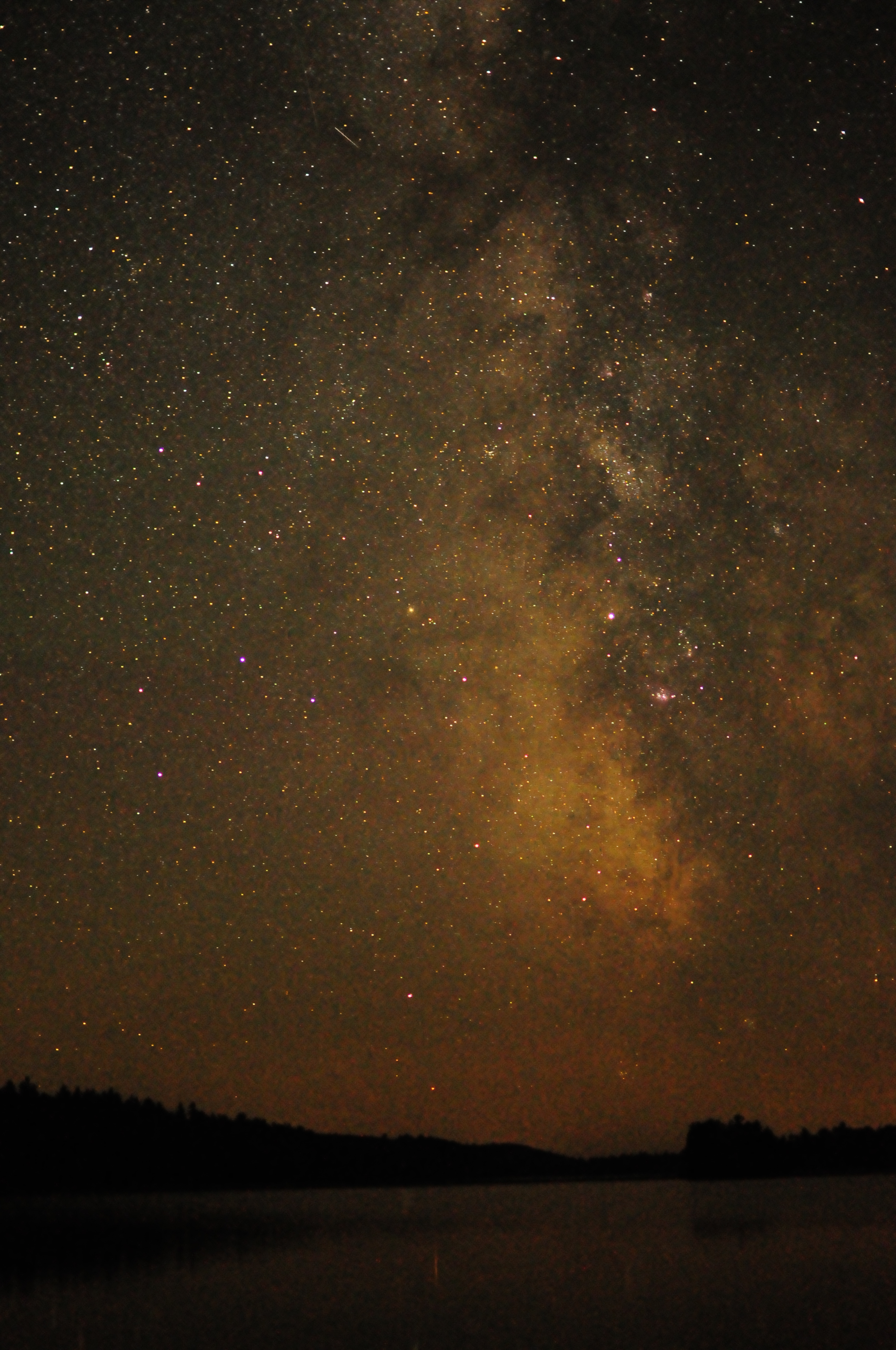
The Milky Way above Lake Burntside, near the Boundary Waters Canoe Area
But it is the non-physical lessons we learn in the wilderness that might be the most powerful. Wilderness travel lies in contrast to our otherwise ordinary lives in the front-country. The wilderness is a place to break out of our comfort zones, a setting where we are forced by necessity to be different, more capable human beings. Out in the wild, you survive on your own wits, or with the companionship of traveling partners. You learn to make do with what you have, or you learn to do without. You begin to realize that small things can lead to big consequences—and, instead of procrastinating, you learn to check problems before they become too big to handle. You become more organized in your daily life, more resourceful with what you have on hand, and you become adept at recognizing cause and effect. You become better at planning ahead. You are forced to live in the moment; foul weather can either foil your prior plans or fine weather can just as much beckon you to linger on. You learn to embrace and deal with the uncertainty of changing plans. And the people you travel with—whether you chose them or not, you will learn to entrust your life with those people, and you will take risks and grow close to them too.

Sunset over Rose Lake, Boundary Waters Canoe Area Wilderness
All of these things are lessons we can learn and take away from experiences in the wilderness; because, we cannot take the wilderness itself with us—we can only take the memories of our time spent in the wilds. And all of these lessons transfer quite readily to life in civilization, because, you don’t necessarily even need the wilderness to learn these lessons in the first place. But in venturing out into the wilderness, you learn these lessons quickly, and you learn these lessons more thoroughly. Every time you venture out again into the wilds, you are reminding yourself of what you’ve already learned. Though you cannot bring the summit with you, the knowledge and skill of being the person the wilderness made you out to be is something you can carry with you indefinitely. This is the art of living that Daumal was referring to. But you needed that summit first to get there.
And what better place to learn these important life lessons than the wilderness. In wild lands, where nature lies stark and beautiful, “where the earth and its community of life are untrammeled by man, where man himself is a visitor who does not remain (1).” Beauty in the wilderness is intrinsic, and the feeling of remoteness is simultaneously intimidating and enlivening. Endless summit vistas and labyrinth-like waterways have an inherent value of their own. It is worth visiting these wild places regardless of any life lessons gained there. But critically important is the knowledge of who we can be that we take away from wilderness experiences. It took the summit to get there, and once there we could not stay forever. But we can keep the memory of the summit, and we are better people for having gone.
Happy Summiting.
(1) Wilderness Act of 1964

Jordan Mountain, Absaroka-Beartooth Wilderness, Montana

Beyond the Realm of what the Internet can Prove
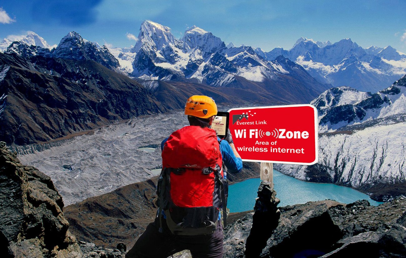
Outdoor trips into the backcountry are special for a multitude of reasons. Some of those reasons are for things that are in the wilderness itself—like pristine vistas and contact with primeval nature. Other reasons to go to the wilderness are for what’s not in the backcountry. In the wilderness, the ubiquitous conveniences of modern life are stripped away, and we enjoy for a time a life more rugged and simplified. One of the most impactful conveniences that goes missing in the backcountry, for instance, is Wi-Fi and cell service for our smartphones and internet devices.
Now, in our everyday modern lives in civilization, we get accustomed to having this technology omnipresent, and internet access is only ever a few swipes and clicks away. This access to instant information has changed the way we live and relate to each other. For example, if we have a pondering or a debate with someone over a fact, we can easily whip out our phones and fact-check via the internet. Swipe, click. Information accessed. Case closed.
But in the backcountry, we don’t have this luxury…or, maybe this curse. Without ready access to the internet, countless intellectual debates of ours remain unanswered while on trail in the wilderness. And without on-screen entertainment to control our minds, we find plenty of time to banter with those around us. Quite naturally, a lot of questions will arise and small arguments will develop as to which certain facts are true or not from such conversational chitchat. On the trail, we find ourselves thrust back into the dark ages of when all we had available for the reference of knowledge was our own mere speculation on the subject.
But the speculation is often the funnest part, even more so than finding out the answer. Such speculation forms much of the conversation building among a group, especially in wilderness travel. Without a definite answer available immediately from the inter-webs, we are free to sit around and banter without fear of the subject being put to rest definitively and prematurely. The point, after all, is not to figure out what is the technical difference between a fruit and a vegetable, if water is wet or not, or if ‘funnest’ is actually a word. The point is to use these meandering conversations to build rapport with your fellows.
If you come across a burning question on your backcountry trip, you’ll just have to delay the satisfaction of finding out the answer until later. Delayed gratification in finding out an answer can really build the anticipation of finally knowing. Or, maybe you’ll just forget the question entirely by the time you emerge back into civilization. And just maybe, when you do find out the answer to that question you’ve been wondering about for so long, you will all of a sudden be flooded with nostalgia for the trip and all the conversations that occurred on it.
But then there is the realm of ponderings beyond what the internet can prove to be true or not. These ponderings arise on wilderness trips, but also in civilized life as well. We as a culture have become so accustomed to having our questions answered so quickly and easily by a quick Google search that we take knowing things with certainty for granted. But on some matters, the internet just has no say whatsoever. It remains silent, no matter how much you Google search. Some parts of life’s mysteries just have to remain unanswerable. This is myth. This is folklore. And this stuff is interesting. While on a wilderness trip, or in everyday life, the speculative conversation may turn towards the legendary side of things. This is where tall-tales really take off. Why doesn’t Camp Widjiwagan, for instance, travel to the Sturgeon Narrows anymore? Are they haunted, as some say, or just patrolled by unwelcoming locals? And is Nye Cabin really haunted? Have spooky things happened in that cabin, caused by the lingering ghost of old-timer Bud Nye? Or is it just your imagination? Either way, the internet remains silent.
As much as you’d search and search, the internet will provide no information on the matter. These fables are folklore only. Unprovable, but still growing more magical and mysterious by the speculative banter and hearsay surrounding them. They are the stuff of myth and legend. And I remain very happy that in some parts of life, there are places where the internet can’t touch.

Breaking Ground, Leaving Tracks
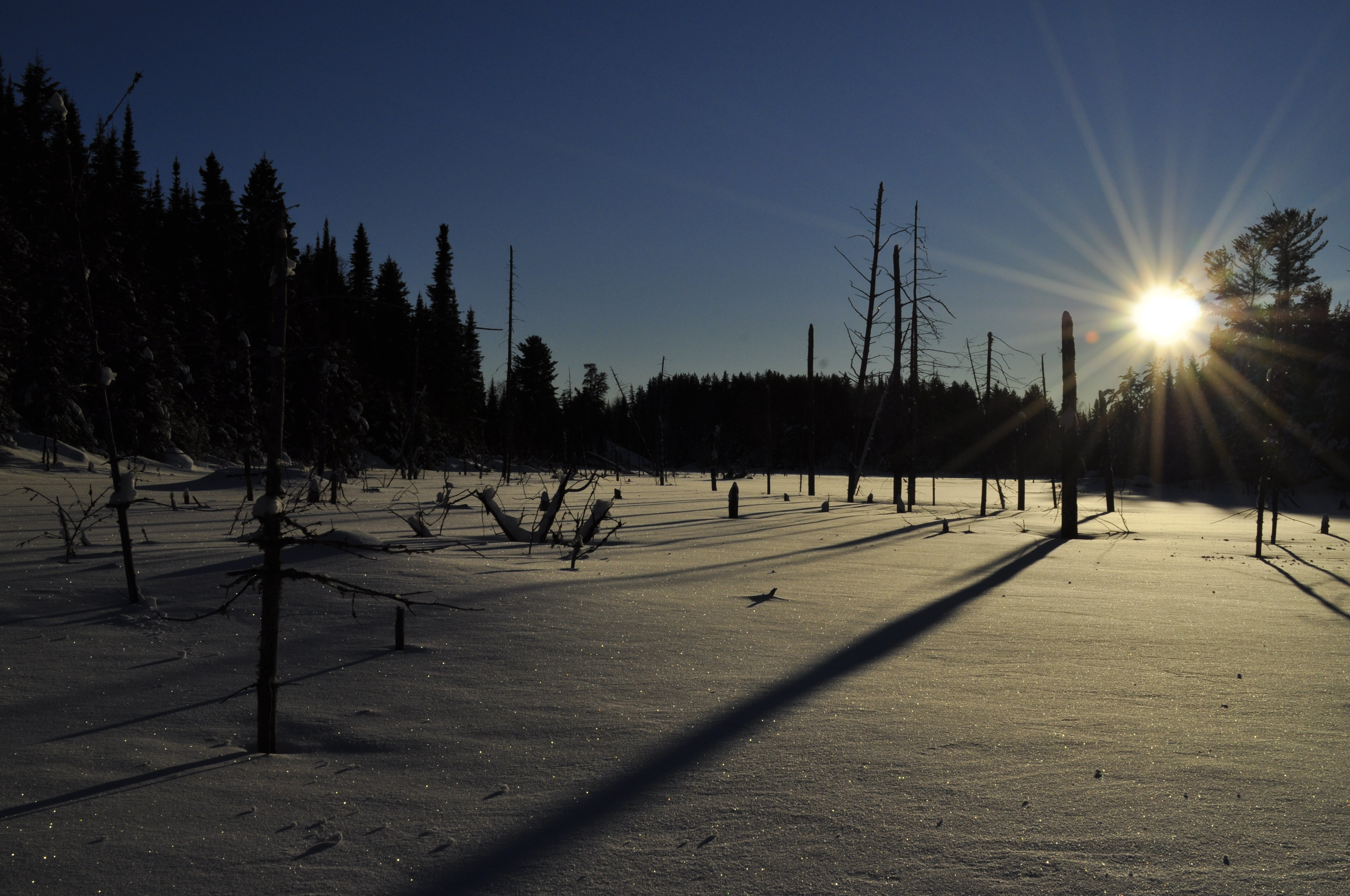
There is nothing like stepping away from the road and heading into a new part of the watershed…. “Off the trail” is another name for the Way, and sauntering off the trail is the practice of the wild…. But we need paths and trails and will always be maintaining them. You first must be on the path, before you can turn and walk into the wild.
—Gary Snyder, The Practice of the Wild
The explorer sets foot into deeply drifted snow. His foot sinks in drastically. Step after strenuous step, disappearing into the piled white drift. He has been breaking ground for miles. No human traffic has ever plodded this course before, it appears to him. No tracks lead the way, no trail is to be found. He is a pioneer, a trailblazer. The explorer pauses and glances behind him. A meandering line of post-hole marks reveal the way he has traveled. He has broken new ground, leaving tracks for future others to follow. But at this moment he is profoundly isolated, deeply embossed in the awareness of his lonesome situation. No human has trod here before. It is a spiritually awakening experience.
Except that this is not the real story of our explorer. The deep snow covers over the facts of the situation. Our intrepid voyager is not actually far from civilization, nor is he navigating somewhere no one else has been before. In reality, he is on a well-used path, a popular trail. His feelings of solitude and accomplishment are the result of the recent snowfall across the landscape, which has erased all marks of this path being a well-traveled route. Though he may not be as much of a trailblazer as he imagines himself to be, the sentiment which the situation has produced is what’s truly significant. He mythologizes his status as an explorer in his psyche.
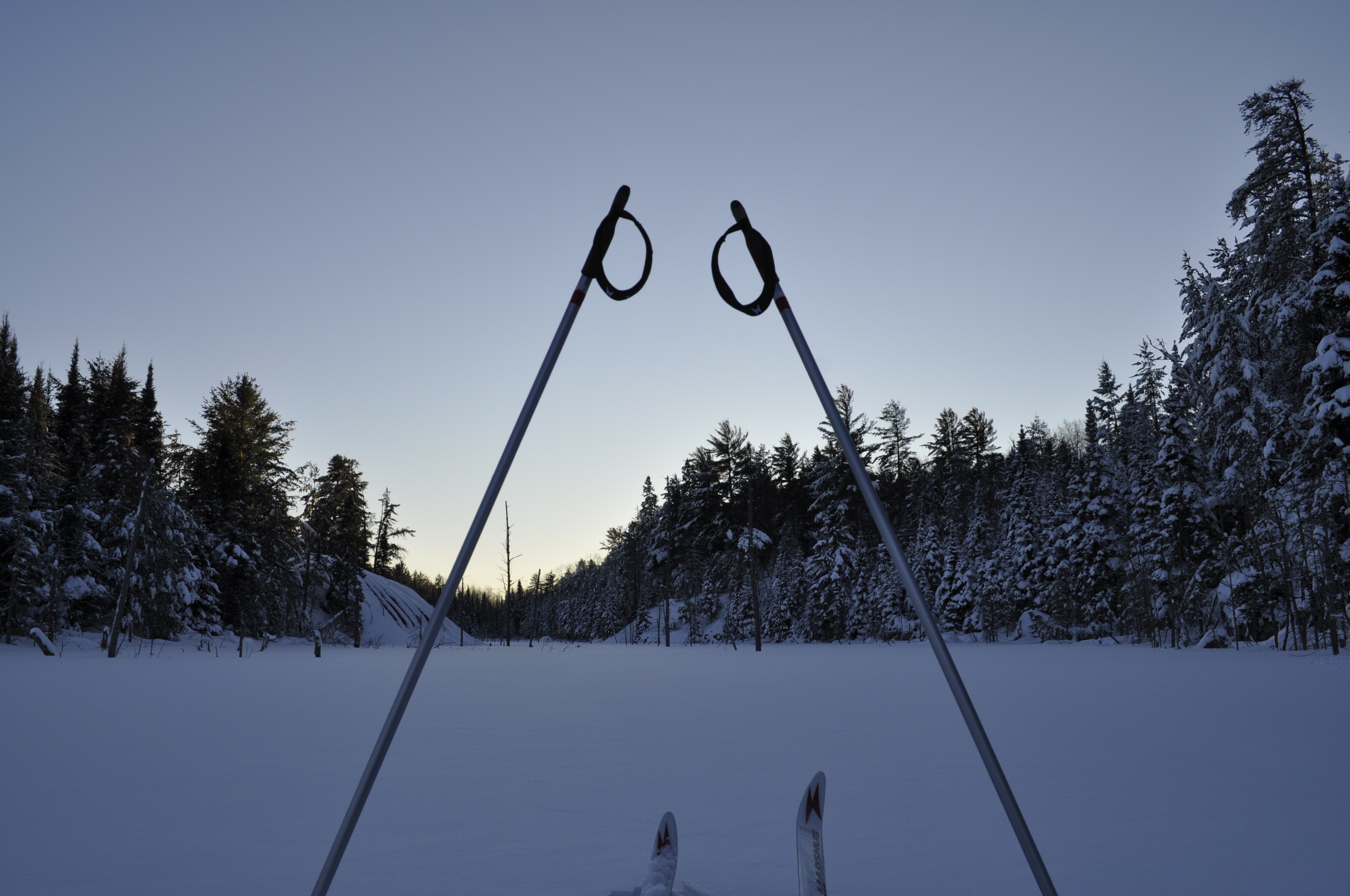
Perceiving oneself as a trailblazer is an elevating experience, giving a sense of one’s own agency and accomplishment in navigating this world. Wilderness travel frequently produces this mentality in individuals. The wilderness, or even merely unmanicured nature, is a setting where the marks of modern civilization are absent, or at the very least harder to notice. To spend time out in the wilds is to put yourself into a situation where you are disjoined from your routine life, a place where the tracks of any forbearer’s presence goes unobserved. You go there to be pushed out of your normal element, to challenge yourself and come back a different person. You go there to break new ground.
The wildlands of America have tracks and trails abounding. Our wilderness is a well-traveled place. Yet millions of users visit these lands every year, and still leave them without revealing a trace as to their passing. Sharing a responsible use ethic of wild lands is what preserves the illusion of isolation and pioneering for future travelers. It is near impossible to say that you have encountered a place where no human has ever stepped foot before, and quite debatable if there remains any place on earth untouched by human presence. But whether you are the first to visit or the millionth, these wild places leave you with the feeling that you are perhaps the first. The wilderness setting invokes a sort of primeval satisfaction deep within you that you alone are independent, that you are indeed a trailblazer.
This is one of the feelings that keeps bringing me back to wild places. I am not the first to pass this way. I know that. But out in the backcountry, out in the forests, out on the rivers, out in the mountains, out in the deep snow it sure seems like I am the first.


Making the Memories You Will Love to Look Back Upon

Recently I took a trip down memory lane with a fellow co-conspirator of one of my most memorable spring break trips ever, a canoeing/backpacking trip to the wilds of Mississippi. It was a trip to be remembered not only because of the adventure but also because of so many things that frankly went haywire:
One of our cars breaking down on the first night in the country town of Effingham, Illinois; sleeping in our cars in the parking lot of the repair shop that first night waiting for the shop to open in the morning; taking a pilgrimage to the second-largest cross in America beside the freeway while waiting for said car to get repaired; running into a traffic jam at a police checkpoint on the highway late at night in muggy Mississippi—and having the power braking go out in the car during that episode; awaking our first morning in Mississippi to gunfire from local turkey hunters wandering through camp; canoeing down a river traversing from bank to bank the whole time because no one in the group actually knew how to canoe; nearly stepping on rattlesnakes sunning themselves on the trail—multiple times; having a deer run through camp at night and scare the living bejesus out of us; having one of our friends get bit by a water snake while we were bathing in the creek; visiting Alabama’s Dauphin Island on the last day of our trip and finding out there were no campgrounds to stay at—so instead after much searching, eventually knocking on a random parsonage door at night to ask if we could sleep in a parking lot (and instead getting invited to sleep in the church’s retreat center!); a fateful morning of napping on Dauphin Island’s beach, leading to second-degree sunburn and sun poisoning before driving through the night back to Michigan; stopping at a place called Hart’s Fried Chicken and ordering the greasiest things on the menu before the drive; washing all of our clothes at a friend’s house before the dorms re-opened, and then finding out that the dryer was broken; some friends finding ticks engorged in uncomfortable places after arriving back from the trip; it could go on…
Some might say that on this trip a lot of things went wrong. Personally I’m not apt to call these events wrong as such—more so, the events of the trip just went much differently from our idealized expectations of an uneventful vacation. Reflecting on the premises of the trip reveals that running into some snafus seemed likely. We were, after all, only a group of ten friends—sophomores in college—without any significant experience canoeing or traveling in the backcountry (and perhaps our resumes were lacking for road trip experience as well). But despite all the happenings and dangerous circumstances encountered, we all survived to tell the tale. We can look back fondly and humorously at the entire experience because no permanent harm was done (perhaps with the exception of guaranteeing ourselves skin cancer).
This trip to Mississippi stands out from other trips I’ve taken particularly because of the number of things that went unexpected. Looking back, the whole trip could have been written as a comedy sketch. How many goofy things could possibly happen in this episode of college wilderness spring break? On trips I would take in the future, I would apply the lessons I learned from past mistakes. I would gradually get more comfortable in the outdoors, make better trip preparations, and foresee adverse situations before they would arise. Things got a lot easier with more experience. But I also found they got less memorable.
The following spring break was also a canoeing trip with friends, this time on Florida’s Suwanee River. The entire trip went off without a hitch. No car trouble, no inadequate provisioning, no half-baked plans. It really was a trip you could wrap up neatly and put down in the books. But I felt a little shortchanged from it. I felt like I got off that trip a little too easy. Somehow, I felt like I had been gipped. Thinking about the Suwanee trip years later, many fine details of the experience are largely forgotten, and few stories about it have been re-told. The trip itself does not possess much salience in my mind either.
I think this example of these two spring break trips illustrates a trend I’ve noticed in my life. As someone who learns quickly from past experience, I don’t possess anywhere near the level of greenness or naïveté I had in my early college days. I’m now able to get through life easier without committing so many of the egregious errors or faux pas of my younger years. As I get better at navigating the messy world of life, I’ve noticed one unintended consequence: I’ve been making these distinct memories of unexpected circumstances with far less frequency.
I’m aware of this trend, and part of myself is frightened that I’ll stop making memories quite as spectacular as my Mississippi spring break. I’m concerned that life will become mundane and routine, and the vivid experiences of life will slip into the hum-drum milieu of quotidian tedium. I’m afraid that I’ll no longer be making the memories which I’d love to look back upon. Psychological research details how our lives mellow out as we age. I was a mellow personality to begin with, and I’ve already seen myself soften out more as I’ve gotten older. As I mature further and gain more life experience, am I going to find it increasingly difficult to make specific memories? Am I going to run out of things to try that are absurdly outside of my range of expertise—or will I even lose the motivation to try such things?
I wonder if this fear is one of the reasons why I’m wary of settling down, why I keep flirting with transiency and playing hard-to-get with consistency. That instead of doing one thing in one place for a long time, I keep wandering from place to place and from job to job seeking out new places and experiences. I’m no longer absurdly incompetent in a lot of areas as I once was. Years later, I have become very proficient in outdoor travel. I’ve even worked as a canoe guide. If I were to take it again now, a trip like my Mississippi spring break would likely present little challenge to me.
Instead, I find myself seeking out new areas in which I will continually challenge my limits, branching out into more and more disciplines. Once I felt comfortable with my level of mastery at the things that interested me most, I had to start seeking positions further afield where I could step yet again outside of my comfort zone. True, part of my motivation for doing this is the desire to develop new skills in other disciplines. But I am also motivated by the challenge of doing things that I’m not familiar with and the memorable experiences that ensue.
And this process of doing things outside of my comfort zone, I’ve found, is a key element in adding to the memory-making process. It’s something I can control that augments the production of memories. Truly, my working holiday in Australia was partly motivated by this, especially by a desire to break from the monotony of going to grad school day after day and living a stable life in the same house for two years in a row. The scope of my Australian journey was a stretch for me, and how it comically unraveled produced many great stories and memories about how naïve and unprepared I actually was. But—I learned so much from that experience that if I were to do it again, it would be far easier for me—and also much less memorable.
I still find myself drawn to employment positions that are slightly out of my comfort zone and realm of experience as well. In fact, it seems to be a job requirement for me. Substitute teaching in public schools has been a great example of this. I was incredibly nervous before I started subbing, and I still often feel out of my element in the classroom. But I have accumulated a treasure-trove of memories and stories from the experience (although my most vivid memories are of just how awful children can act). Though far from a professional, even after just a few weeks of subbing I’m beginning to feel more comfortable leading a classroom. I wonder if that’s a sign it’s time to try something new?
Am I drawn to the memories? Am I addicted to them? Am I drawn to novelty and repelled by familiarity because I covet the memories that novelty so often provides? Am I scared that based on the trends I’ve seen so far, that I’ll eventually run out of things to do in order to make new memories? Is my incestuous desire for vivid memories stifling my development?
I want to keep making new memories, though, and memories that will stick around with distinction. The question may be how to go about this. How can I still make new memories and lead a more stable and consistent life? Somehow I need to find a way of continuing to make mistakes worth learning from. As long as I survive those mistakes, I’ll be able to look back on those memories fondly.
