Category Archives: Place

Chasing Light

It seems I’ve been chasing light lately. First an Austral Summer below the Antarctic Circle. Then a Boreal summer above the Arctic circle. In a few day’s time, shortly after the autumnal equinox has ushered in fall to the northern hemisphere, I will board a plane and fly back to the southern hemisphere for the start of spring. I seem to have become a season hopper.
With three summers in a row without a winter season in between, you’d be forgiven if you thought I was chasing warmth and sunshine instead of chasing daylight. Though astronomically speaking, the seasons have been summer, traditional ‘summer’ weather has been neither what I was seeking or have experienced. Last December I spent the solstice in Antarctica, though even the peak of summer there felt climactically akin to my brethren at home in the Midwest. This June, I was in northern Alaska for the solstice. Yes, temperatures could rise and be unbearable under the full, circling, blazing sun—but it could also become cloudy and reach temperatures within the range of snowfall. Indeed, though the daylight has indicated summertime, these summer seasons haven’t always seemed particularly ‘summery.’
And here I go again, back to New Zealand, back to the southern hemisphere, and back into another summer season. It wasn’t by design that this happened—circumstances and the development of life decisions just produced this unintended result. While working in Antarctica last October through February, I met someone who convinced me to join her on a thru-hike on New Zealand’s Te Araroa trail. So, while the days are short and the snow falls in the northern hemisphere, I will be on the other side of the globe chasing the warmth and summer season as we hike the island together. As we follow the trail from north to south, we will be reaching higher and higher latitudes where in summer the days become longer and the nights are short.
In the temperate mid-latitudes where New Zealand lies, the distinction between periods of night and day are pronounced, but not extreme. But life, as well as the landscape, reaches towards the extreme the more one goes poleward. And beyond the Arctic and Antarctic circles, the land goes from 24-hour sunlight in the summer to 24-hour darkness in the winter. The polar regions are places of extreme seasonal differences. The summer season knows not the winter season, and the transition between the two is abrupt with only truncated springs and falls. From the sun circling overhead continually in the summer, there is only a short transition until the suns sets and never peaks above the horizon in winter.
I have seen firsthand the way the sun wanders aimlessly around the polar summer sky, circumambulating. At McMurdo Station, Antarctica, 77.5 degrees south, I spent 118 days without a sunset. When it finally did occur, the first sunset of the fall was a momentous occasion. The residents of McMurdo piled outside to watch as their faithful sun companion dipped briefly below the horizon, only to rise less than an hour later. And though the sun had officially set, it was far from night, and would be for quite some time. In the beginning of fall, the sun stays so close to the horizon that it remains civil twilight for hours after sunset. Not until a month and a half after the first sunset of the fall does McMurdo experience its first true minutes of night.

With traditional distinctions between day and night becoming muddled at the poles, day and night become somewhat irrelevant. How is one to tell the passage of time when one cannot tell when one day slips into the next? In summer, the sky remains constantly lit. Day rolled into night, but the night seemed just like the day.
In Antarctica, during the summer season, I ended up working the night shift at McMurdo Station. Though the 24-hour clock that the research station ran on considered the shift to be ‘nighttime’, there was no darkness. The only indicator of night was that the throngs of researchers and science support staff hanging out in the galley would slowly subside; there would be a few hours of peaceful quiet while the station slept, until folks began to roll into the galley for coffee and breakfast at the start of another workday. Meanwhile, in those quiet hours in the wee of the morning, the sun was at its lowest angle on the horizon, sending in radiant beams of light through the bank of galley windows—a middle of the night golden hour.
I had no problem adjusting to working the night shift after spending my first few weeks on station as a daytime worker—the sun was as bright as always, and I did not feel like I was sleeping away and wasting daylight as I had felt when I worked overnights for big-box retail. Inside my windowless McMurdo dorm room, the lights were always off. When I needed nighttime, I could retreat to my room and sleep soundly out of the sun. But were I to choose to go out and play instead, the sunlight would be my constant companion.
I had more experience living under the midnight sun this summer, as I led a 50-day backpacking trip north of the Arctic Circle to Alaska’s Arctic National Wildlife Refuge. Our latitude was not quite as high as McMurdo—only at 69 degrees latitude—thus the extremes of sunlight were not as pronounced. But what this trip to Alaska lacked in sheer latitude, it made up for in intensity of experience. Gone were the modern conveniences of McMurdo Station. There was no longer any indoors to hide in, no eternally dark dorm room or dimly-lit dark bar to retreat to. Instead, we were out in the backcountry with no more than we could carry upon our backs. Our only shelter was a thin-walled tent, and the daylight filtered right in. We either made friends with our eyemasks, or we learned to sleep in the light. Once again, the time of day became irrelevant—there was no hiding from the constant presence of the sun.
It took a number of days before I lost the nagging feeling that comes after looking at the late hour on my watch and feeling the pressure to get a hustle on to make camp before darkness falls. Throughout the duration of the trip, I kept tabs of the time on my watch—not out of necessity, but more out of a curiosity of how our circadian rhythms were adapting. Our days slowly dragged out to be longer, as we stayed up later enjoying each other’s company and slept in longer the following mornings. Thus, we ended up being awake through the darkest hours of the day, and even towards the end of the trip after the sun had been setting below the horizon, the light remained with us. Even in the depth of night on our last day in the Wildlife Refuge, it remained light enough in the tent to read a book.
In spite of the mounting fatigue from daylight that comes with constant exposure to lightness, I appreciated the daylight as a benign and amiable companion in a remote and unfamiliar terrain. Here we were, traveling for weeks in the Arctic National Wildlife Refuge, where wolves and grizzly bears roam wild. The signs of these animals were all over—tracks, scat, kill-sites. But the daylight made the wilderness seem friendlier. All told, we saw six wolves and seven grizzly bears on the trip. Seeing the bears and watching their natural disinterested movements in the daylight provided much more psychological comfort for us than wondering if out in the darkness somewhere was a bear lurking just outside the tent.
At about the same time on the trip that I began to miss the creature comforts of home—dry feet and doorways instead of tent zippers—I also began to miss the darkness. Aside from being able to sleep better in the darkness, I began to miss darkness not for darkness itself, but for what it brings to us. The constant daylight drowns out the stars all polar summer long. I’m constantly reminded that people forget this, as I am asked quite often if I saw great stars or aurora. Unfortunately, I was able to see neither stars nor aurora, much to the disappointment of my star-gazing self. And too, having the darkness creep in at the end of the day provides a natural daily cycle of gathering in your shelter for rest. Darkness too, lends itself to gathering around a campfire for light and warmth. Though we did have a campfire on the riverbank one night in Alaska, the magic of the fire just wasn’t the same in the light hours.
As much as I began to miss the darkness, when it finally did come, it felt uncomfortable and foreign. Towards the end of our trip, the nights had been gradually growing dimmer. But right after leaving the Wildlife Refuge, we caught a shuttle ride to Fairbanks, which sits below the Arctic Circle. Darkness descended upon us as we camped in Fairbanks that night. For the first time in nearly two months, it was no longer light enough outside to walk around without a headlamp. The feeling was unfamiliar. Suddenly all the scary feelings of darkness came rushing back in that gut-wrenching primordial fear of the unknown. My how easy it is to forget what darkness is like!
This coming summer, the distinction between day and night will not be as pronounced as I hike the Te Araroa as it was when I spent time closer to the poles. The mid-latitudes will provide a kinder balance of light and darkness each day. Nevertheless, as fall and winter begin to descend on the northern hemisphere, I will once again be off chasing light.

State of Mind, State of Being
space
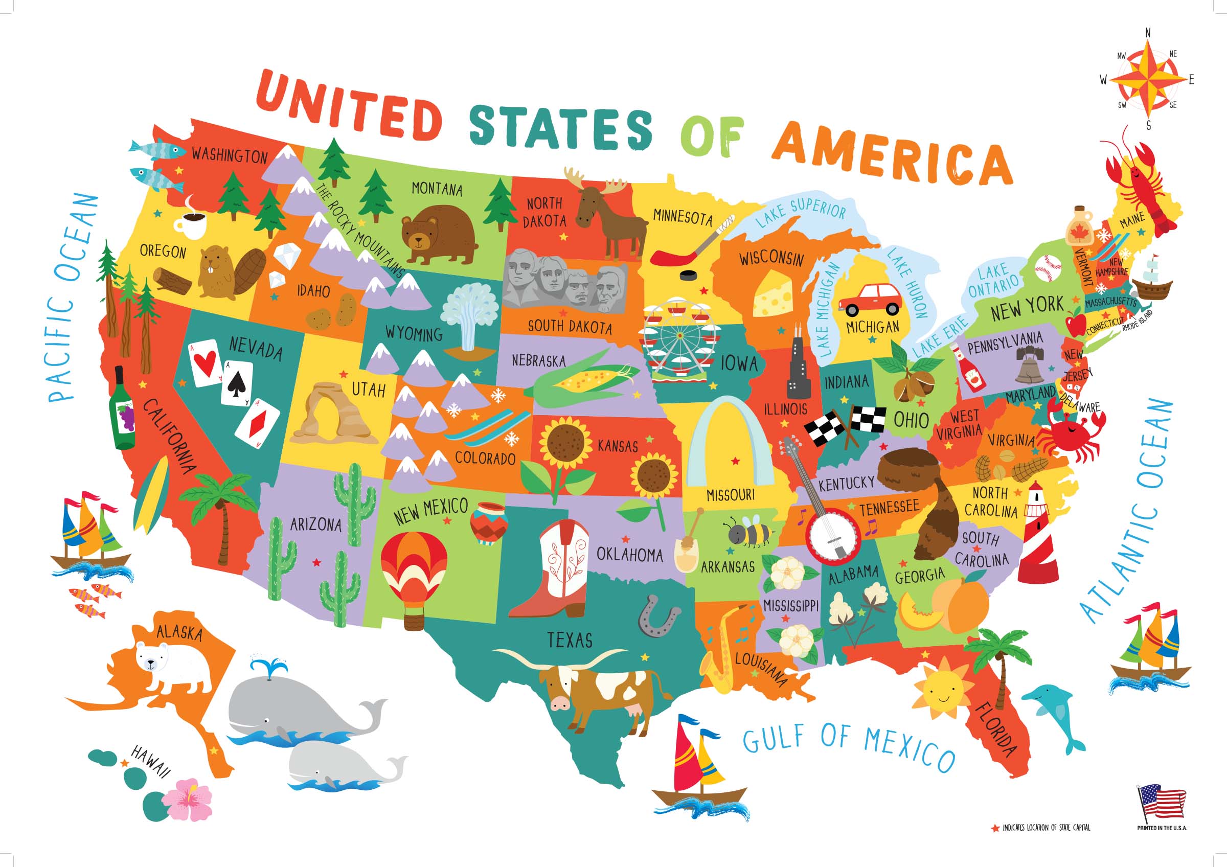
The United States of America, with its fifty nifty geographical sub-units, neatly divides up this diverse nation into different states that each has a generalized culture and personality. As someone who is not yet settled down with a permanent address, I still have the flexibility and open-endedness to decide which state I want to live in for the long haul. From working jobs in a variety of locations, I have gotten a taste of many different geographies, a smörgåsbord of potential places to call home. In any given year, I seem to work in about three different states, which doesn’t usually include my birth state of Michigan. This prolonged period of ‘geographical investigation’ has given me some insights into where I might want to settle permanently based on my experiences in each state. While I have explored around the country quite a bit (see this page on my personal website for the most up-to-date map of U.S. counties I’ve been to), I’m a northerner at heart—I’ve never stayed long in a place under 40°N. And while I’ve worked jobs on both the East and West Coasts, I always return home to the Midwest.
From my adventures, I have my own thoughts about potential locations to settle, as well as to what my ‘soul state’ might be. But I thought I’d elicit some help from the omniscient ether—by taking a number of sleazy internet quizzes to see where the quiz writers think I belong. These quizzes—though far from scientific—are quite fun to play around with. I’ve listed them here according to my self-rated quality of the quiz, from best to worst:
What were my results? Out of seven quizzes taken, surprisingly none of them yielded the same state. However, there seems to be a strong connection to northern New England, as I was matched with Maine, New Hampshire, and Vermont (even though New York is not considered part of New England proper, I’ll clump it in with this category because the most desirable part of New York for me, Upstate, has a lot in common with northern New England). These four states—charming small towns, more rural populations, historic places, and winding roads through hills and deciduous forests—all seem to be a good match for what I’d be looking for in a habitat. The quiz from Quizony was the only one that picked what I consider to be my ‘soul state’ of Vermont: fiercely-independent, sustainability-minded, ample greenery, and the fewest Wal-Marts of any state.
space

space

space

space

space
And as for my natal Midwest? Sadly, no quiz matched me with my birth state of Michigan. I guess it turns out that I don’t fit in with the bulk of the state, though I think quite highly of life in the rugged frozen Upper Peninsula (Yoopers are a special breed, and I don’t think I could ever live up to their cred). I was quite happy that Wisconsin appeared as a match. I really am fond of the upper Great Lakes region, especially around Lake Superior, and I’ve been quite frequently perusing for real estate in northern Wisconsin. Cheese curds and a good football team? Count me in.
space

space
Then there were two far-flung results. Washington State, with its forests, mountains, and avid outdoor recreation culture seems to be a good fit for me. And though I enjoy visiting and recreating in the west, the West Coast has never really felt like home to me. Finally, my most out-there match was with Tennessee, provided by Buzzfeed. Apparently the quiz determined that I have an undiscovered penchant for country music that makes me belong in the South (even though when given the quiz question for musical preference, I explicitly chose rock over country).
space

space

space
Of course, no online quiz can ever compare with the process of getting to know a state in person. So get out there and start exploring to find your own perfect state!
space
space
space

A Royal Walk: Hiking across Isle Royale
The Sun Rises Over Isle Royale
It was the middle of May 2018 when I first landed on Isle Royale. That storied island—that mass of rock isolated in northern Lake Superior. So far away it seems logically like it should be part of Canada, yet it belonged to Michigan—the only National Park in my home state. The mystery of that island beckoned me from maps with its geography and isolation. Long had I wanted to discover what this coveted gem had in store.
At long last, I finally visited the island after spending a winter and a spring teaching environmental education in northern Minnesota. By that time, I had become quite familiar with the boreal northwoods from all those hours teaching kids in the wilds. The northern forests, hence, were not all that different from my everyday existence.
Given my years of anticipation, Isle Royale was bound to be something exceptionally different than what one could experience on the mainland, I believed.
As it was, my first trip to the island was a simple, short overnight stay, ferrying in from Grand Portage, Minnesota to the Windigo Visitors Center on the western end of the island. As far as landscapes go, the flat, forested, mixed-conifer forests of Windigo are not spectacularly different than the Minnesota Northwoods I had become accustomed to.
I was a bit underwhelmed.
I didn’t even bother to take any pictures (incidentally, my camera had broken earlier that trip).

Arriving at Washington Harbor at Windigo
I left Isle Royale that trip convinced that I had seen the island in the wrong way. A simple overnight trip was no way to do the island ecosystem justice. If I was ever to return to Isle Royale, I thought, I would do it in the right way: I would hike the island from end to end, slow enough to absorb the ecological transitions, to understand the essence of what makes the place, and to enjoy immersion in the vast isolation of Isle Royale.
As chance would have it, in the summer of 2019 I was selected to take part in a volunteer restoration crew on Isle Royale’s Rock of Ages Lighthouse. I would be returning to Isle Royale sooner than I had thought, and this time, I would be staying on to hike across the island afterwards.
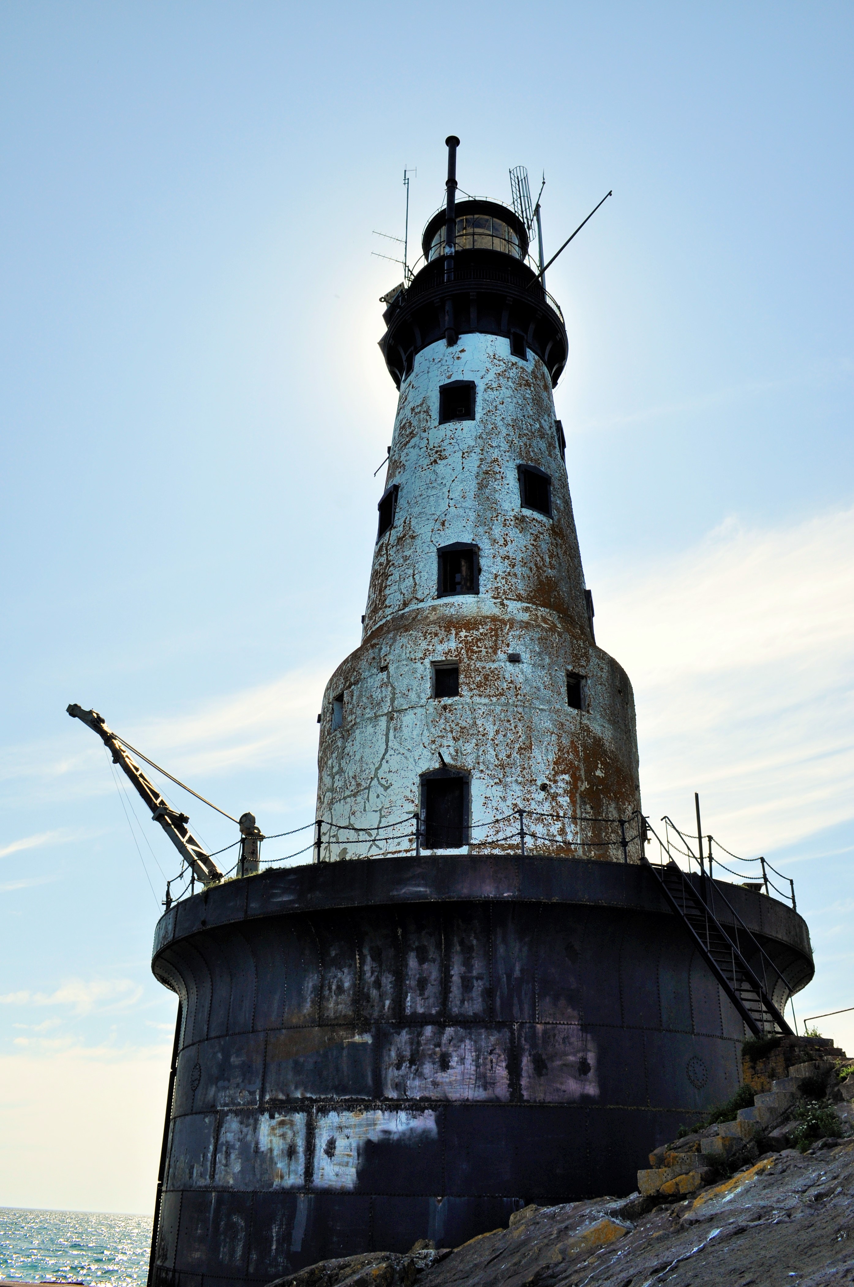
The Rock of Ages Lighthouse
I started my hike on the western end of the Island, at Windigo, the widest part of the island. Here the forest commands the land and the coastline is smoother, less jagged. I made my way to the Greenstone Ridge trail, the hiking path that transects the middle of the island. Despite its name, the Greenstone Ridge at this point isn’t much of a ridge at all. The trail slowly climbs uphill under the cover of a mixed-forest—conifers, but also maples and even the warm-and-dry loving oaks. I spent my first night at the interior campsite of Island Mine, the site of an 1870’s copper mine that peaked and was abandoned in only a few years.

Broadleaf forests found more commonly on the western end of the island
Mining history would be a big theme of the hike, and copper was the resource of value. It wasn’t just white Euro-Americans who were mining the island either: the Ojibwe, the indigenous people of Isle Royale, had mined the island for thousands of years. Archeological evidence suggests that as early as 4500 years ago, indigenous people harvested copper by using stones to hammer off chunks of native copper from outcroppings in the bedrock. As their technology progressed, they began to mine deeper in the bedrock by building large fires over ore deposits, then quickly dousing the fire with water in order to crack the bedrock. Small indigenous mining pits can still be seen throughout Isle Royale today. By the 1840’s the Objibwe had been duped into ceding their lands to settlement and development for the resource-hungry Americans. Speculators flocked to the island to make their riches, but mining on Isle Royale was always boom or bust. Island Mine organized in 1874 and extracted over 200,000 pounds of refined copper. Three years later, the company went bust. All that remains now are scattered pieces of rusting equipment and mounds of tailings.


Day two saw me continue east along the Greenstone Ridge. After a few miles of hiking through the shady canopy, I began to get my first views from the ridge: small, rocky clearings at first with scrubby oaks and small shrubs partly obscuring the views. First the clearings were few and far between, but then they became more abundant. From the ridge one could begin to see some of the inland lakes that dot the island, including the scenic Lake Desor, near the summit of Mount Desor, which at 1,394 feet is the highest point on the island. From clearings further along I could even see Ryan Island in Siskiwit Lake, the largest island in the largest lake on the largest island in the largest lake.


With the gradual opening from shady forest to open ridge, another fun thing happened: berries. Up on the ridge, the sun beats down and the soil becomes dry. The seasons progress quicker than by the lakeshore where Lake Superior tempers the weather. Whereas the thimbleberries at lower elevations were still hard and green, up on the ridge I began to encounter a progression of ripeness: first, an isolated red berry, then a few on a bramble, and finally whole thickets of the bright red berries. Thimbleberries are a thornless, velvety cousin of the raspberry, with shallow bright red berries which are so soft and juicy that they can only survive the journey from the hand to the mouth.
After gorging myself on snacks of thimbleberries and taking a mid-afternoon swim in the cool and clear Lake Desor, I made my campsite at Hatchet Lake.
The clear summer weather finally took a turn for the wet on my second night. It was a constant heavy rain that slowly drenched me. I awoke (did I even sleep?) with about an inch of standing water in my tent. I later learned that at Windigo they recorded nearly two inches of rain in that overnight.
I would start my third day soggy. Today I would be leaving the Greenstone Ridge trail for the north shore of Isle Royale and the infamous Minong Ridge. I reached Lake Superior at Todd Harbor, a picturesque cove with a mélange of water-smoothed rocks. I took a short side hike to the former open pit of the Haystack Mine, and then followed a trail just a little bit further to find a small waterfall that was the cause of some bubbling noise off in the distance. From Todd Harbor I took the Minong Trail towards McCargoe Cove. The Minong Trail, though it never reaches as high elevations as the Greenstone Ridge, deserves its reputation as a knee-destroyer. The Minong Ridge is a series of exposed escarpement ridges: a rocky, uneven gradual climb up the bare basalt, followed by a steep dropoff on the backside. Then repeat, again and again. On a hot day, it wears you out, as it wears out your knees.


I reached the deep and slender McCargoe Cove by mid-afternoon, and after such a soggy night, I was eager to rest and dry out. This afternoon, I finally got a shelter at one of the island’s campsites. They are spacious lean-tos, screened-in, and with the perfect combination of both scenic views and isolation. I dried my clothes off and basked in the sun.


Though McCargoe Cove was my favorite campsite of the hike, there were not many people there at all. Isle Royale consistently is the least visited national park in the contiguous 48 states. In 2017, this National Park had only more visitors than Lake Clark, Kobuk Valley, and Gates of the Arctic National Parks, all sites in remote interior Alaska. With only 28,196 people even paying a visit in all of 2017, more people visit parks like Yellowstone in a single day than all of Isle Royale in an entire year. The great benefit of Isle Royale’s lack of popularity is its solitude. The trails and campgrounds never feel crowded. With fewer folks around, you also develop good connections with your fellow travelers quite readily. At McCargoe Cove, I spent the evening around the campfire chatting with our only neighbors: a group of fishermen from Chicago and a pair of ladies from the Twin Cities. Trail community seems to come easily here.

McCargoe Cove: Some Hike, Others Canoe
McCargoe Cove was also the harbor used for the Minong Mine, the most prolific mine in Isle Royale’s history. Like other island mine sites, indigenous people had harvested surface copper deposits here first. In 1872, modern mining operations had commenced at Minong. This mine produced some incredible finds, such as a 5,720 pound nugget of almost pure copper. Finds like this nugget, and several other massive nuggets, added fuel to the mining fire. Two shafts were dug, up to 300 feet deep, as well as several drift tunnels that followed the ore veins. As tunnels were dug, tailings, or waste rock, began to fill in the adjoining marsh that leads to McCargoe Cove. A boomtown known as Cove sprang up at Minong, housing upwards of 150 people at its peak. Along with its railroad, stamp mill, and blacksmith shop, Cove even boasted a post office. Indeed, the prospect of permanent settlement on Isle Royale seemed so promising that Isle Royale even became its own county in 1875. By 1885, however, all mining operations on Isle Royale came to a halt for good. The grade of the ore dwindled and the price of copper fell; Isle Royale proved to be too isolated and the winters too harsh. Eventually, even though over 4 million pounds of refined copper were removed from the island, all mining ventures proved too non-economical to continue. Island boomtowns were abandoned. By 1897, with no permanent population left, Isle Royale County was re-absorbed into Keweenaw County.


On my fourth day, after very much enjoying my single-night stay in the shelter, I was off to hiking again. This time I decided to traverse the island from north shore to south shore, hiking astride several interior lakes along the way. I had been told that these interior lakes were hotbeds for moose activity. As storied and prolific as the moose population on Isle Royale has been, I had yet to see my first moose on the island. I knew they’d be around, as I had already seen plenty of moose scat and browse sign.
The scenic and shapely-named Chickenbone Lake proved of no avail for moose, though it was a Mecca for giant dragonflies. The next lake over, at Lake Ritchie, I got my first far-off glimpse of a moose browsing in the aquatic vegetation far across the lake. With the gradual decline of the predatory wolf population, the numbers of moose on Isle Royale have skyrocketed in recent years, with an estimated 2,000 moose inhabiting just over 200 square miles of island (learn more about Isle Royale Wolf-Moose dynamics here). I would only end up seeing one other moose on my trip. After losing the hiking trail on some bedrock, I wound up following a moose trail into the woods. The moose trail petered away until I reached a swamp. Suddenly, a large startled moose crashed away from me through the brush!
Though I had seen two moose, as far as their illustrious predator the wolves went, I had yet to see any. When I had visited previously in 2018, there was just a pair of wolves left on the island, simultaneously a brother-sister pair and a father-daughter pair (you do the math on that inbreeding!). In the winter of 2018-2019, four more wolves were introduced to reinvigorate the existing wolf population. For anyone, seeing a wolf is a rare treat. Alas, I never had a wolf encounter on the island; the closest I got to seeing the wolves was the island cabin of well-known wolf-moose researcher Rolf Peterson.

Moose researcher Dr. Rolf Peterson’s Rock Harbor cabin
Once at the south side of the island, I camped at the large harbor of Moskey Basin. Completely different from the small, sparsely-filled campgrounds I had been staying at, Moskey Basin was filled to capacity with both families and large groups, and its vast expanses of exposed bedrock and its picnic tables made this site feel luxurious and tame. But I should have expected that, visiting in high season after all. Even in high season, though, Isle Royale is not that busy, and getting all of that wilderness ambiance while hiking was a treat not to be taken for granted.
The cove at Moskey Basin was a sight to behold—layers of exposed bedrock outcroppings running right into the water. I hadn’t noticed it too much before, but the island was becoming rockier and rockier the further I traveled east. The exposed rocks left plenty of good places for sunbathing and also proved to be a prime habitat for blueberries (thimbleberries, unfortunately, had all but disappeared after leaving the Greenstone Ridge). Also without my noticing, the broadleaf tree canopy had disappeared too. Thin soils could no longer support the large broadleaf trees seen more westerly on the island. Instead, the forest was becoming more a stunted array of firs and spruces.


With a clear night ahead looking promising, I made a commitment to staying up to see the stars. This being mid-summer in the westernmost Eastern Time Zone, the sun did not set until near 10pm, and the stars did not emerge until well afterwards. After a full day of hiking, I was usually in my tent well before the stars came out in their full glory. But I stayed up tonight and was treated to a show on an absolutely moonless night. Being miles away from any human settlements, the stars on Isle Royale are absolutely amazing!


My last day on Isle Royale would take me into the primary tourist outpost at Rock Harbor. Rather than hugging the shoreline trail to my final destination, I once again went inland to take the Greenstone Ridge home. The trail up to the Mount Ojibway Fire Tower was never too steep, provided uninterrupted views, and proved to be premiere blueberry habitat. The whole climb up I had a constant handful of blueberries as a power snack. The Mount Ojibway Fire Tower, unlike its much squatter kin at Mount Ishpeming, actually provides visitor access to the base. Climbing the tower provides views of the entire island from north to south.


The Greenstone Ridge continued its path northeast across exposed rocky and grassy balds. By the time I reached the Mount Franklin lookout, it was clear I was encountering a different area. The overlook was populated with day-tourists hiking up from their various Rock Harbor lodgings. I left the viewpoint and went on the downhill to Rock Harbor and my hike’s end. At the eastern end of the island, Isle Royale’s tilted geology splits the island into many narrow peninsulas and long bays running towards the northeast. I walked along these deep harbors right along the trails by the edge of Superior’s turquoise waters.
A sign for campsites signaled that I had made it into Rock Harbor. I could now bask in the luxuries of this tourist depot. Modern settlement at Rock Harbor started with a few unsuccessful mining ventures in the 1840’s, then moved into the realm of commercial fishing, as Scandinavian immigrants built their fishing shanties after the copper booms. By the early 1900’s, these fishermen were guiding pleasure-seekers around the island and accommodating throngs of tourists in cabins. Several resorts eventually popped up, having their heyday in the 1920’s. The Great Depression and changing societal tastes caused a drastic decline to tourism in the 1930’s. By 1940, Isle Royale had been declared a National Park, and the National Park Service began the process of buying out and shutting down the remaining tourist resorts and removing fishermen from the island. Gradually, this formerly logged, mined, and settled island would be transformed into a 99% wilderness park with no permanent population.
Today Rock Harbor boasts a store where one can buy fresh vegetables as well as craft beer, hot showers ($6 for a five-minute shower), laundry, a restaurant, rustic cabins, and even a few hotel rooms. For this wilderness traveler, it was a world apart from the Isle Royale I had just experienced. The development at Rock Harbor was a foil to the isolation of the island. Though I milled about the Rock Harbor Village for a while, it just wasn’t what I needed. I made off to a quiet edge of Lake Superior and took a long, cleansing swim in her waters. For me, that is what Isle Royale is about.

Rock Harbor Lighthouse

Minnesota Winter Time-lapse
A compilation of time-lapse sequences shot in winter in Minnesota. Enjoy!
Sunrise at Grand Marais Harbor, with the schooner Hjordis. December 2018.
Total lunar eclipse of the Super Blood Wolf Moon, January 20, 2019, as seen from West Bearskin Lake, Minnesota.
Sunset at Camp Menogyn Sauna, with Fisheye Lens. January 2019.
Temperance River. December 2018.
Duluth’s Aerial Lift Bridge at Night. November 2018.
Nightfall over the City of Duluth. November 2018.
Sunrise shadows across Hungry Jack Lake, as seen from Honeymoon Bluff, Superior National Forest. February 2019.
Hooking up the dog team during Fall ATV training at Amarok Kennels. November 2018.

Counting by Counties
An item on many people’s bucket lists, including mine, is to visit every one of the fifty United States. It’s a large task, considering the vast size of our country…but then again, it’s not too challenging when one considers how large most states are and how merely transiting around this country will often result in unintended visits to new states and to new places. As for me, before I reached the age of 27 in 2017, I had already set foot in 48 states and the District of Columbia. Mapped out, it looks like I have visited most of our country:

But for how many people, is visiting every single county in the United States on the bucket list? Instead of a mere 50 states, the total list extends to 3,142 counties*. For fellow alumnus of Calvin College’s Geography Department Tom Byker, this was a very intentional goal. Byker started his earnest quest to visit every single American county after beginning college, and this county-visit project was one highlight on his resume that helped him in landing a job at the navigational company TomTom. Tom recently brought his county visit project to a close after visiting his final county in Hawaii in 2017.
Inspired by the fine-scale travel goals of Tom Byker and the other ‘County Collectors,’ I decided to make my own map of county visits, mainly out of curiosity of where I’ve been in each state. I have never kept a formal list of counties that I have visited, so the entire map is based off memory of past travels I have been on. The majority of county travel has occurred during college and beyond, but I did try and reconstruct the county locations of some early family trips. And yes, I did count driving through a county as adequate for a visit. Here is what my county-scale map looks like:

And what can I learn from the county-level map?
- In total, I have visited 924 of 3,142 counties, which is about 29% of all counties.
- Despite visiting 48 of 50 states, there are still large swaths of the United States that I have not visited, namely the South and the Southeast.
- It becomes quickly apparent in which counties the interstates are. Interstates 94, 90, 80, 70, 44, 40, 35, 55, 57, 65, 69, and 75 all readily pop out, as well as U.S. Highway 2. Can I say, ‘Road Trip?’
- It’s easy to tick off county visits in the Western U.S. Not only is the West a great road trip destination, but the counties are also much larger. For example, Wyoming’s counties average 4,257 square miles while Georgia’s counties average only 373 square miles.
- I have visited every single county in two states: Oregon (completed in 2014 after a 2012 summer internship and lots of Grad School fieldwork in the state) and Massachusetts (completed in 2017, which included visits by ferry to both Martha’s Vineyard and Nantucket Islands, which are their own respective counties).
- Broken down by counties, the states I have seen the least of are Louisiana (<5%), Arkansas (<3%), and Texas (<2%) (excluding North and South Carolina, which I have not yet visited).
- I have visited less of my own home state of Michigan than many other states. I have visited 71% of all Michigan counties, which ranks my home state as only 12th on my list according to percentage of counties visited.
*Here I use the term county broadly to include all U.S. counties or county equivalents. Most states are divided into counties, but Louisiana is similarly divided into parishes, and Alaska is similarly divided into boroughs. Additionally, several states (although primarily Virginia) have cities that are independent of any county. All of these categories are combined to get the number 3,142.
Maps generated are courtesy of mapchart.net
Here is the state-wide data on visits to each state:
| State | # Counties | # Visited | % Visited |
| Alabama | 67 | 16 | 23.88% |
| Alaska | 29 | 3 | 10.34% |
| Arizona | 15 | 5 | 33.33% |
| Arkansas | 75 | 2 | 2.67% |
| California | 58 | 52 | 89.66% |
| Colorado | 64 | 26 | 40.63% |
| Connecticut | 8 | 7 | 87.50% |
| District of Columbia | 1 | 1 | 100.00% |
| Delaware | 3 | 1 | 33.33% |
| Florida | 67 | 10 | 14.93% |
| Georgia | 159 | 24 | 15.09% |
| Hawaii | 5 | 2 | 40.00% |
| Idaho | 44 | 40 | 90.91% |
| Illinois | 102 | 44 | 43.14% |
| Indiana | 92 | 36 | 39.13% |
| Iowa | 99 | 21 | 21.21% |
| Kansas | 105 | 18 | 17.14% |
| Kentucky | 120 | 9 | 7.50% |
| Louisiana | 64 | 3 | 4.69% |
| Maine | 16 | 13 | 81.25% |
| Maryland | 24 | 8 | 33.33% |
| Massachusetts | 14 | 14 | 100.00% |
| Michigan | 83 | 59 | 71.08% |
| Minnesota | 87 | 32 | 36.78% |
| Mississippi | 82 | 25 | 30.49% |
| Missouri | 115 | 22 | 19.13% |
| Montana | 56 | 34 | 60.71% |
| Nebraska | 93 | 19 | 20.43% |
| Nevada | 17 | 9 | 52.94% |
| New Hampshire | 10 | 7 | 70.00% |
| New Jersey | 21 | 15 | 71.43% |
| New Mexico | 33 | 7 | 21.21% |
| New York | 62 | 25 | 40.32% |
| North Carolina | 100 | 0 | 0.00% |
| North Dakota | 53 | 20 | 37.74% |
| Ohio | 88 | 26 | 29.55% |
| Oklahoma | 77 | 13 | 16.88% |
| Oregon | 36 | 36 | 100.00% |
| Pennsylvania | 67 | 40 | 59.70% |
| Rhode Island | 5 | 4 | 80.00% |
| South Carolina | 46 | 0 | 0.00% |
| South Dakota | 66 | 18 | 27.27% |
| Tennessee | 95 | 12 | 12.63% |
| Texas | 254 | 5 | 1.97% |
| Utah | 29 | 13 | 44.83% |
| Vermont | 14 | 7 | 50.00% |
| Virginia | 133 | 14 | 10.53% |
| Washington | 39 | 34 | 87.18% |
| West Virginia | 55 | 6 | 10.91% |
| Wisconsin | 72 | 49 | 68.06% |
| Wyoming | 23 | 18 | 78.26% |
| Total | 3142 | 924 | 29.41% |

Deep Places

The sun begins to set on the smooth rocks of the Tombolo (or Point) of Grand Marais
Close your eyes. Take a deep breath. Where are you? Do you feel connected to the place you find yourself in this current moment? Do you feel an encompassing sense of belonging here?
There are some places that give you that special feeling. Places that feel qualitatively different to the individual. Places that feel alive and electric, a kind of synchronicity between person and place. Places that are energy-giving. Magical, almost.
I like to refer to these locations as ‘deep places.’ The adjective deep is used to describe the immensity of the feeling the individual has towards the place. It is something felt on a higher level, different from one’s experience of everyday locales. These deep places may be spots you already know, or the feelings may arise the first time you step foot into a new environment. If you’ve ever experienced these magical feelings, then you have discovered a deep place for you.
The City of Grand Marais from the mountains lining the North Shore
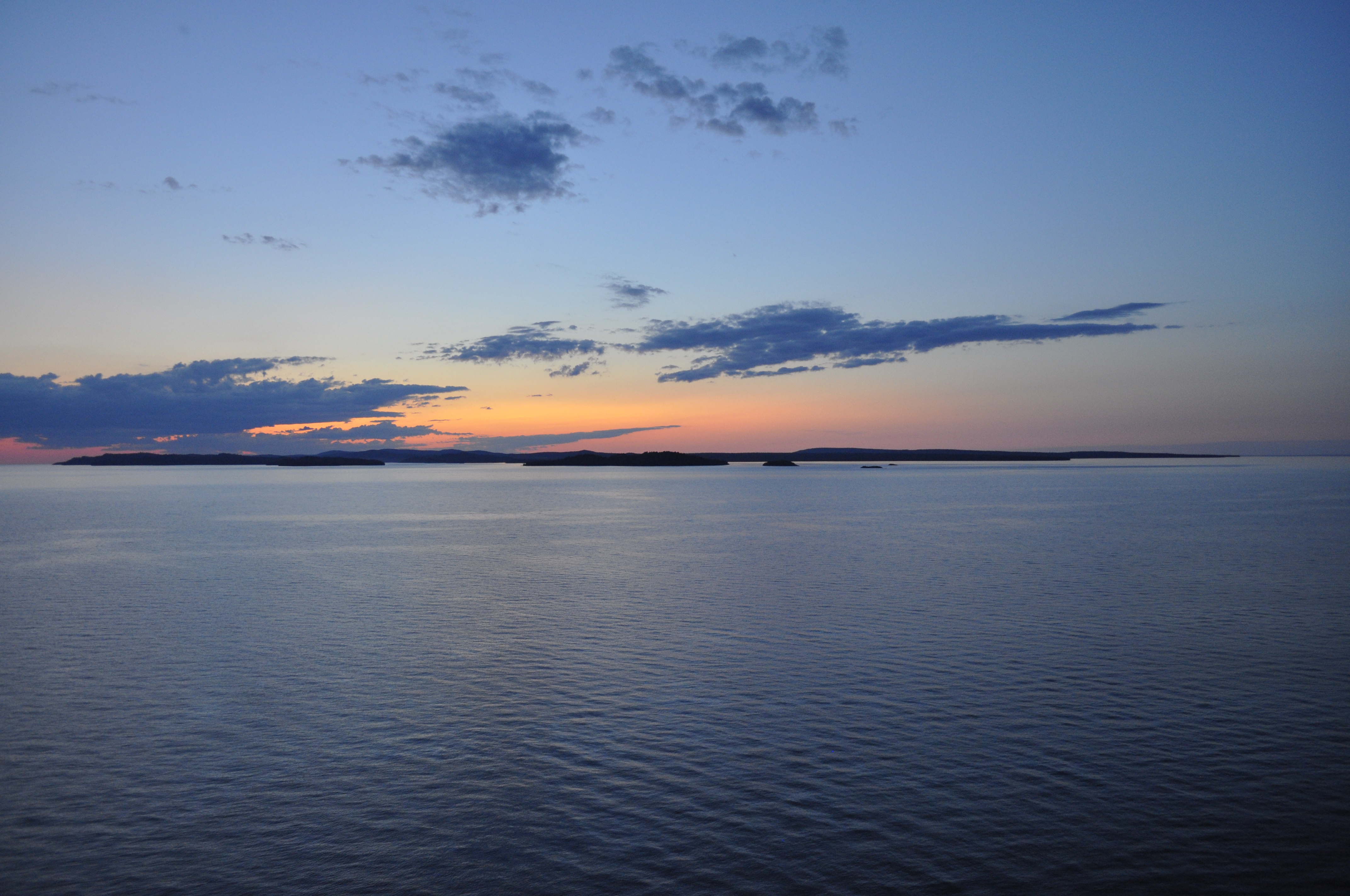
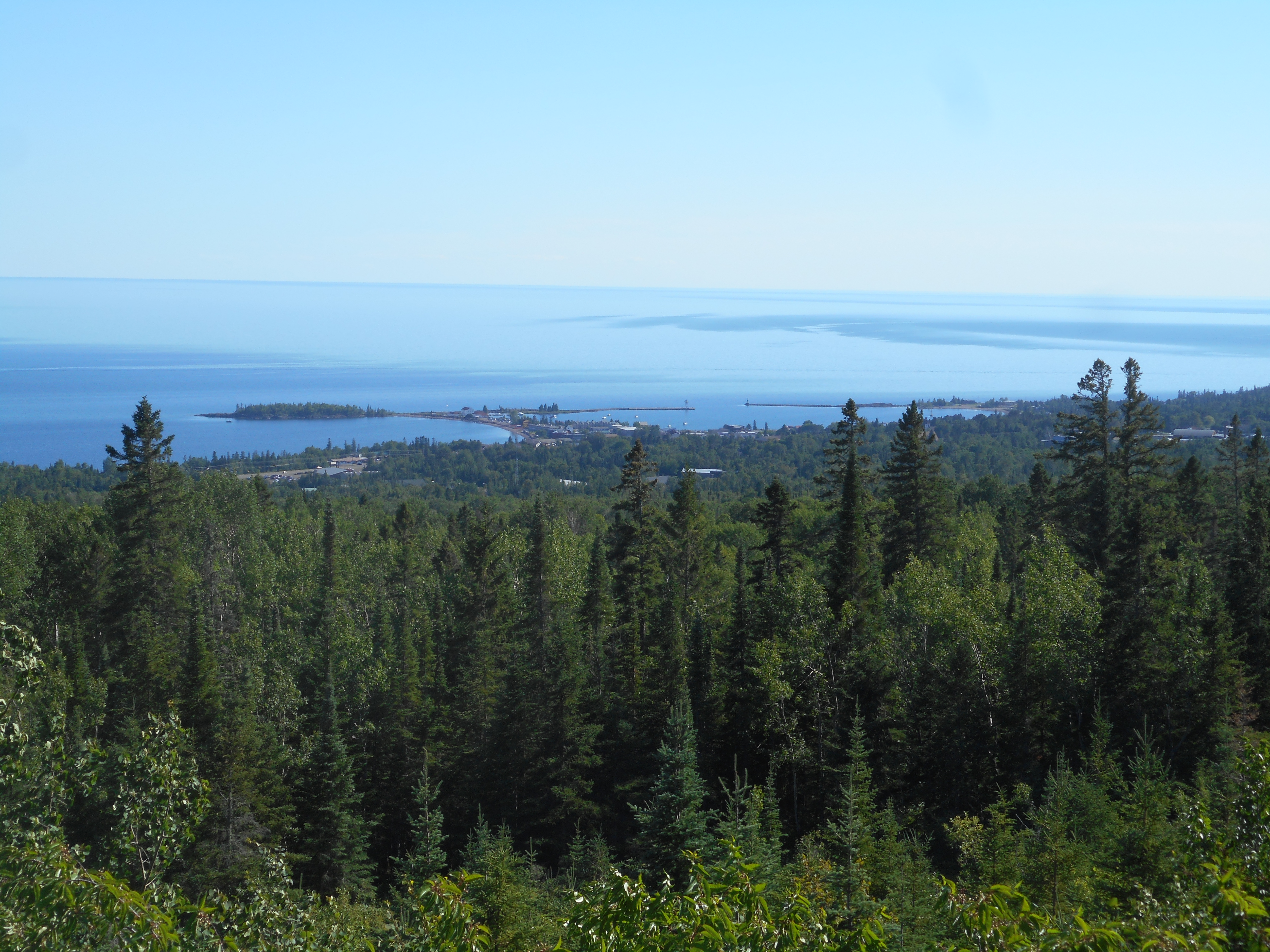
The North Shore of Minnesota, along the edge of Lake Superior, has been one of those deep places for me. Starting in Duluth and heading northeast towards Thunder Bay, the north shore follows a rocky, rugged, forested line for more than one hundred and fifty miles. Along the coast it is a vast forestland wilderness, punctuated only by small settlements and scattered tourist outposts. It is a place where land meets water, where human meets wild. It is a deep place for me.
My first real venture to the North Shore came in May of 2016, entering Duluth from the south just past sundown, being greeted to the sweeping vistas of the big lake in the fading daylight. The northern drive to Grand Marais that night was illuminated by the blood-red full moon rising to its own reflection on the calm surface of Superior. That night was crisp and cool. The moon was out. The stars were shining brightly. The scent of the boreal forests and the water encompassed my nostrils. It was an entirely magical entrance to the place known as the North Shore.
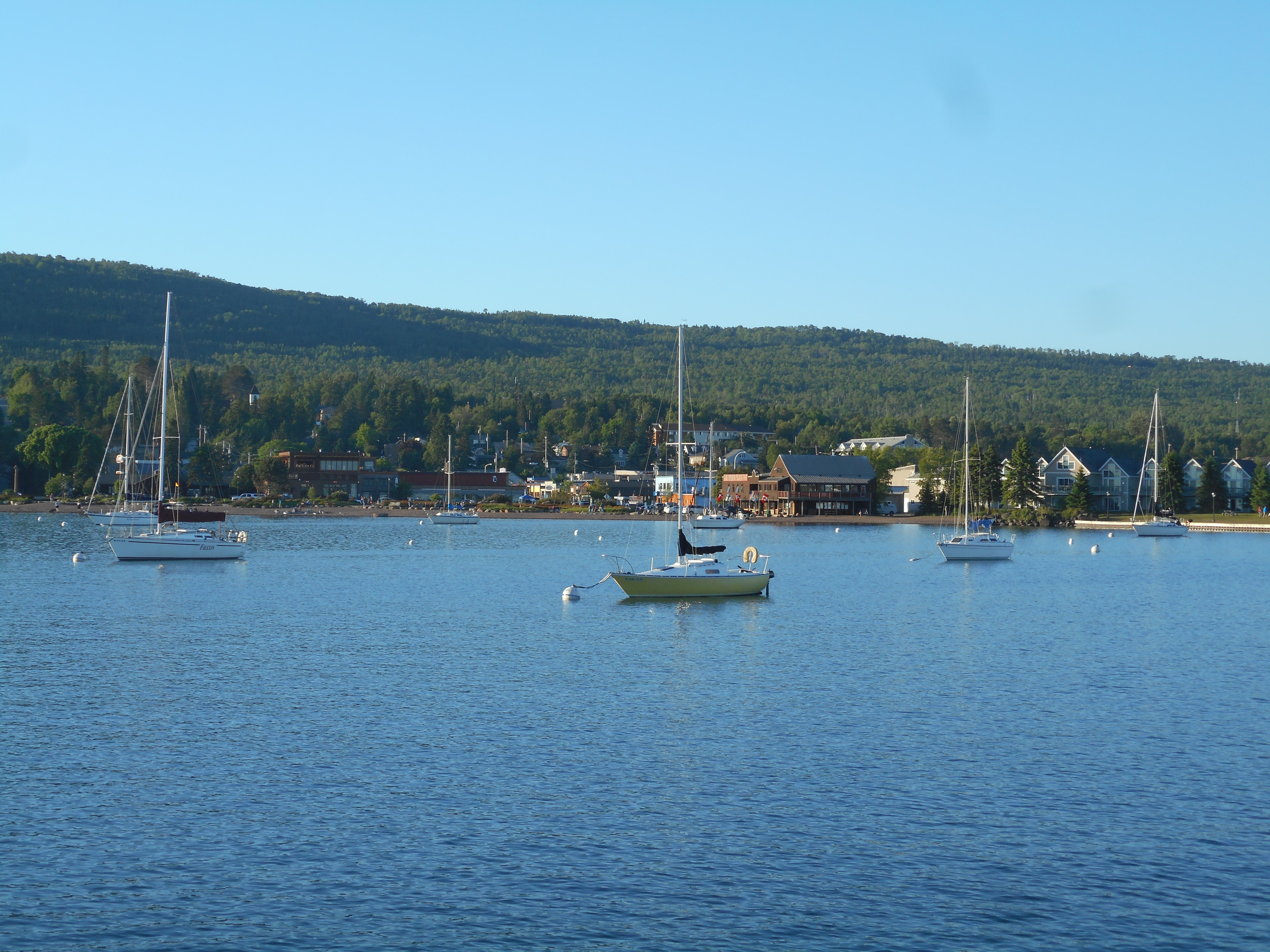
Sailboats finding refuge from Lake Superior in Grand Marais Harbor
Could the magic of my first experience on the North Shore ever be repeated? I have since returned to the North Shore many times, and have found that the magic was not a one-off experience. The feelings I have towards the region have not been diminished through growing familiarity. Every time I return to the North Shore, I am still astonishingly impressed by the astounding physical beauty of the environment. Jutting rusty-color basalt outcroppings, small rivers torrenting their way through deep overlooked canyons, pocket beaches cobbled with a mélange of surf-smoothed rocks. The cultural resources too—lighthouses, cabin complexes, mining history. There is so much to do here—and to keep coming back for more. Every time I would grow claustrophobic from my land-locked residence in inland Minnesota, even a short visit to the shore—to the great lake vistas—would always be the cure I didn’t even realize I needed. My deep place has also served as a restorative space.
The North Shore, for me, is one of those places where I always find more to discover—and upon discovering, find it imperative to come back and revisit again later. Even before I began to explore the region, I had this convincing sentiment that the North Shore would be a special area to me. It is a psychological wonder, how, even upon a first glance at a place, one can feel the initial intimations of inherent belonging and connection to that place. The newly entered deep place is a landscape ever so tantalizingly unknown and discoverable, yet undeniably comfortably welcoming. It’s a place that beckons you to linger on in its space. This sense of fitting into the place is preordained, not earned. You don’t grow to love deep places through familiarity, though they will become increasingly familiar with time. Instead, there is an instinctual, primitive gut feeling that you are part of the place; that you already know and love the area though you have recently arrived.
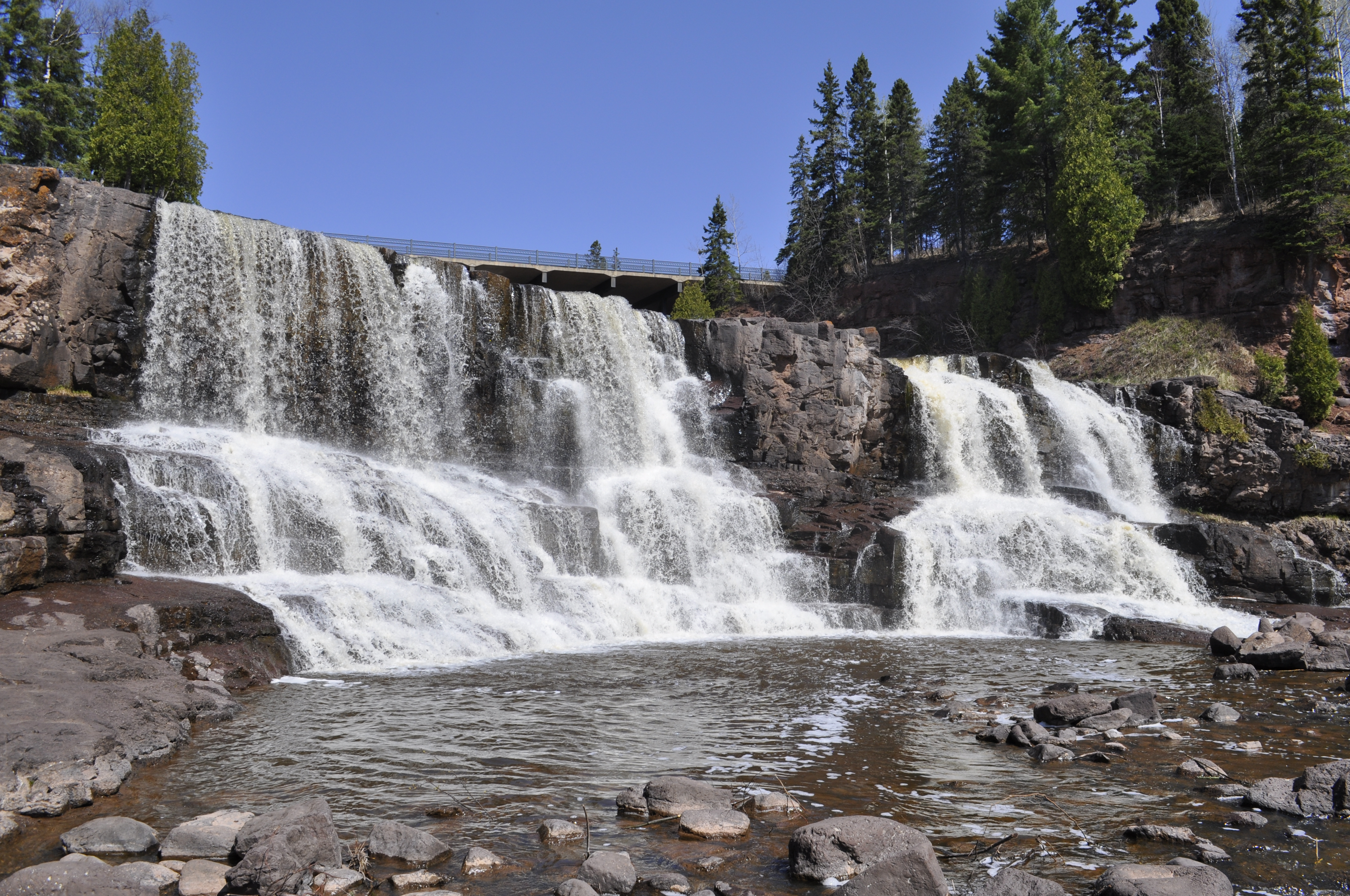
Gooseberry Falls, where water tumbles through basalt canyons from the highlands to Lake Superior
Everyone has, or should have, a deep place of their own. Maybe you know where it is. Maybe you have one but don’t know that you know it yet. Maybe you’ve revisited your place multiple times, or have even come to live there. Maybe you’ve only ever visited once. Even if physical visits are infrequent, even just thinking about those deep places can still conjure those magical feelings inside of you.
It is possible to have multiple deep places too. How many places exist out there in the world where you would feel this distinct connection if only you could visit? Though the North Shore of Minnesota is perhaps my most apparent deep place and the one I’ve revisited the most, I have others places where I have experienced similar sentiments—the Owens Valley of California, or the island of Tasmania, Australia, for example.
The remarkable thing is that while some deep places are shared with others, a deep place isn’t universal. Everyone will find a different space or landscape that speaks to them so clearly. These spaces are simultaneously yours alone and are shared by a community of others. But no matter how many people claim the same deep space, it always feels unique, as if the area were speaking directly to you.
Find your deep place.

The North Shore’s standout cultural landmark, Split Rock Lighthouse

Barns Across the Continent
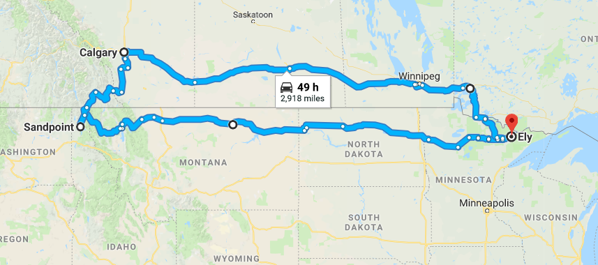
On a recent spring break journey, I drove 3,200 miles across the top the US and Canada—and all I did was take pictures of barns! But the rural country landscape does fascinate me, and I find it particularly compelling to photograph. As I drove across the land, the aesthetics of the structures changed with the landscape. Here is a photographic escapade of the rural journey and what I saw: barns, grain elevators, abandoned homesteads, and more.


And here was the route:

The Barns of Ottawa County
The rural landscape around where I grew up, in Ottawa County, Michigan, never seemed exceptional or particularly noteworthy. The real sites, for me, always laid at the coast, along the sandy wooded shores of Lake Michigan. Only recently, after spending much time away from my hometown, has the rural heritage of my landscape gripped me in a way it hadn’t before. The agricultural scenes that once seemed commonplace and went blithely unnoticed by me now stood out in a conspicuous fashion. I became captivated by my once overlooked surroundings.
Barns, as a subject matter, have long drawn me to capture their images in photography. Now I have felt compelled to turn the cameras towards the barns that I may have seen regularly since childhood, but now notice again with fresh eyes. Winter adds an extra element of beauty to them, lying dormant, coated in a thick veneer of white. They come in many different styles, sizes, and colors. Gambrel roofs, lean-to’s, reds, whites and weathered wood. Some are still working barns, others long since abandoned to the elements. Though common, their ruggedness and utilitarian aesthetic provide an unnoticed kind of beauty.


It’s %$@&£! Cold Up Here!

A Balmy Day in Northern Minnesota
“There is no such thing as bad weather…only bad preparation.”
* Outdoors Proverb *
It’s %$@&£! cold up here in northern Minnesota in January.
But really, it’s not that bad.
The secret, of course, is preparation. With a healthy dose of realistic expectations. It’s no beach holiday up here.
Winter is not winter the same everywhere. Even though I grew up in the northern tier of states, west Michigan’s persistent 30*F winter temps and perpetually falling wet humid snow is no analog for the -20*F clear sunny days here in northern Minnesota.
The cold here is unparalleled in most of the lower 48 states. Characteristically clear skies during the day sparkle light and shadow brilliantly across the landscape. The Minnesota sun, however, is an illusion; though shining bright, it provides almost no warmth to the day. Clear skies at night open up a fantastic theater for star viewing, yet with no cloud cover, what little daytime heat accumulated readily escapes into the upper atmosphere. Temperatures plunge easily to 30*F below.
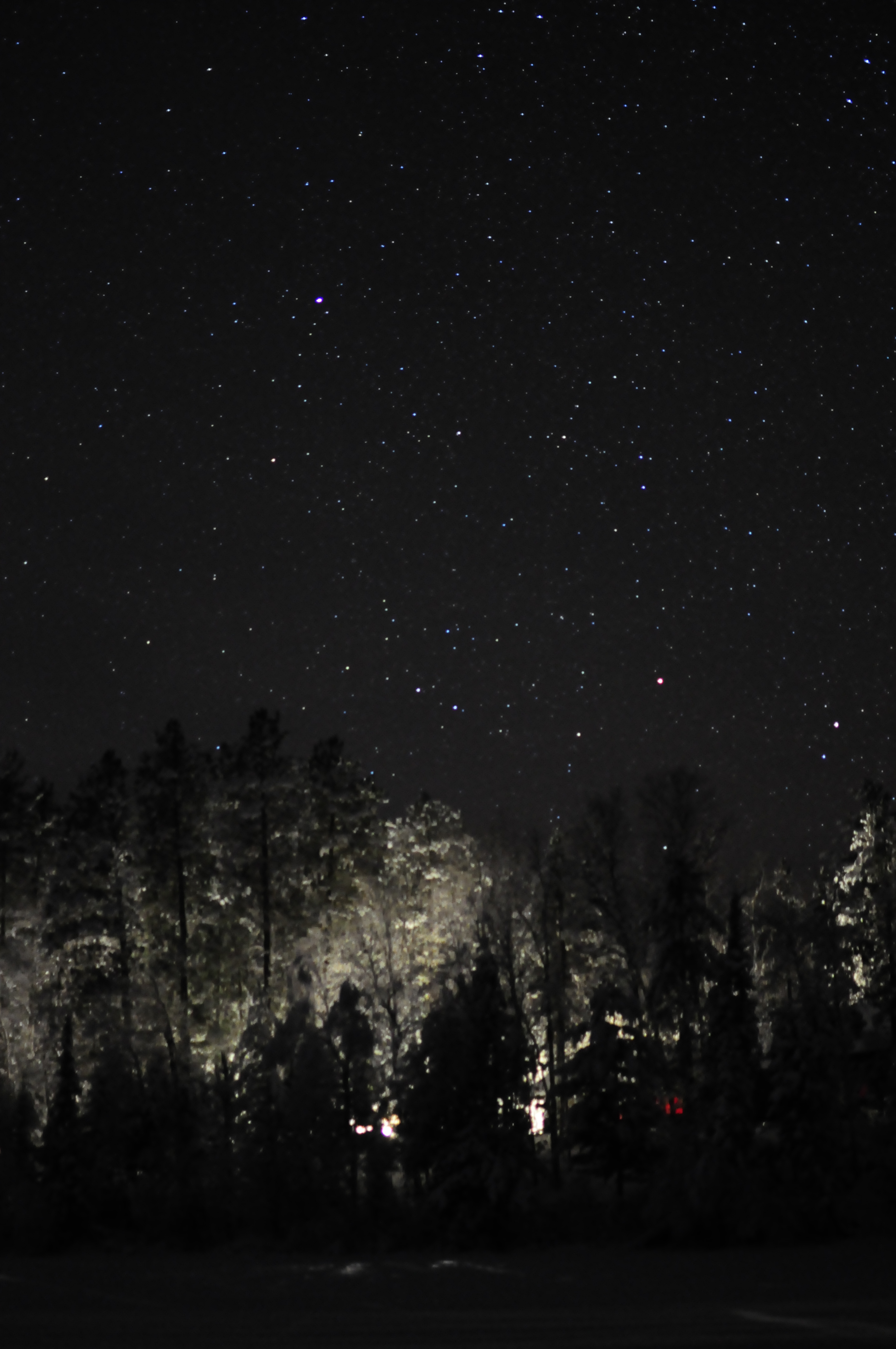
Clear nights allow for excellent stargazing
With the proper equipment and preparation, these polar temperatures can become a comfortable winter playground. With clothing, layering is key. Long underwear, pants, snowpants, sweaters, fleeces, jackets, coats, liner gloves, outer gloves, waterproof boots. All layered one on top of another, overlapping, in a style known as “shingling.” Exposed skin is a recipe for heat loss, especially at the juncture of clothing…not to mention the possibility of getting errant snow down your shirt or in your boots. Even with all these layers of clothes on, the frigid cold still seeps in quickly once you step outside. It’s best to keep moving. Stay active and have your body generate its own heat. When I’m dressed up in all these layers and trudging through a foot of powder snow, I feel like a storm-trooper marching to battle. Bracing for winter is preparing for a war with the cold.

Trudging along in snowshoes is a great way to stay warm in the snow
But don’t expect everything to be easy in the cold. Low temperatures have their own way of letting you know they’re around. Frost readily forms on your hair and beard. Your eyelashes start to freeze together. An unprotected water bottle freezes shut. Batteries drain. Lighter flames grow weak and disappear. Knowledge of the extreme cold and its effects goes a long way in prolonging your own survival in these circumstances.
So even though it’s cold outside, go out and enjoy the day. A beautiful winter wonderland awaits for those who are prepared.
Northern Minnesota’s Winter Wonderland
Sometimes it’s nice to snuggle up inside too: my cabin at Camp Widjiwagan

Landscapes of Introspection and Extroversion

Cape Breton Island, Nova Scotia
“Though your mind continually searches for order and pattern in the ocean waves, there is none to be found. The ocean is perfectly chaotic and achieves a deep sense of beauty which our minds recognize but are scant to understand” —Paraphrased from an Alan Watts Lecture
At times you may find yourself unsettled: angsty, pensive, unsure, angry. These emotions welling up inside of you need a reprieve, an outlet; they need an environment conducive to processing those feelings. Someplace gloomy, foreboding, immense; somewhere to connect with your mood. In times like these, you seek out water, wherever it may be—the beach, on the ocean or a pond, a raging river or gentle stream. Whatever it is, there is something special inherent about that landscape. Something in its sublime beauty eases the tension in your mind. In these over-bearing alien landscapes, there is solace, solitude. Sitting, strolling, or wandering aimlessly lost along the water’s edge, you can feel a change in your psyche. Your anxious thoughts lessen, your mind begins to process what conflicts you. There by yourself, you begin to delve into your inner being. The landscape you have sought has become your conduit towards introspection.
I am one who seeks the water when anxious. The primal nature of the powerful waves awes me, and I feel small and insignificant compared to their might. The calm reflection on a still pond reaches me too, and my mind is soothed by the gently undulating ripples on the surface. Alone in these environs I can recollect myself, dive deeper into myself, come away with a deeper understanding of myself. The water, I have found, is a prime landscape for self-reflection.
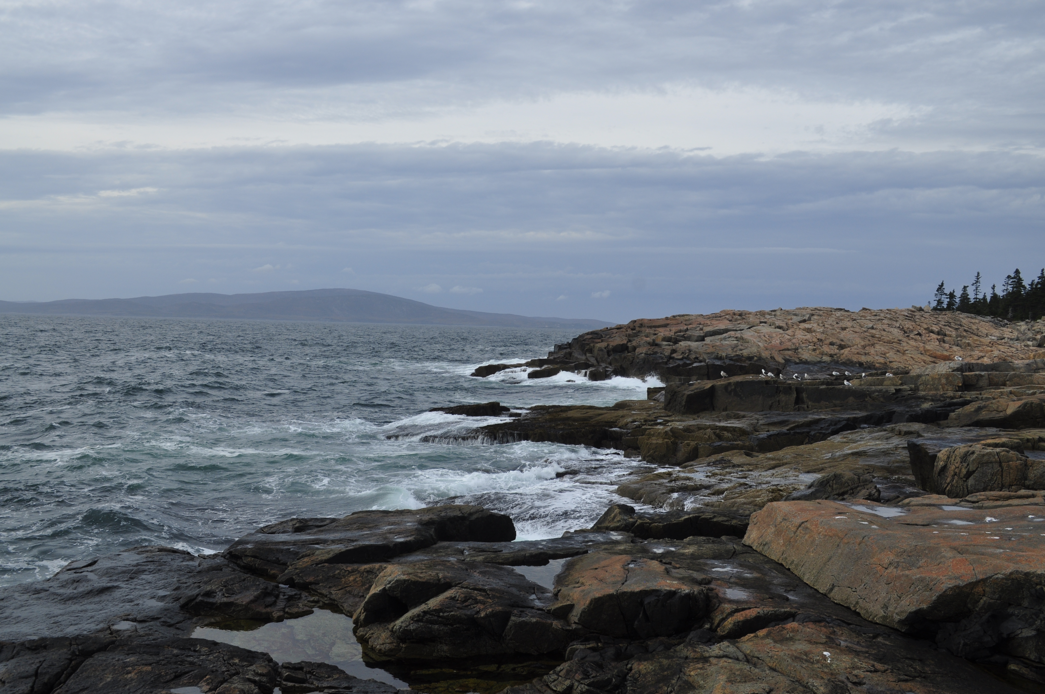
Acadia National Park, Maine
Yet angst and anger—that troubling slew of emotions—is not the sole reason one visits the water’s edge. At other times, you will be experiencing different emotions: tranquil, curious, joyful. In those moments you may not be alone, or even want to be alone. You may be with other people. Regardless, the sheer beauty of the waves and water still works on you and those around you. This environment is different, you can tell. You feel something tangibly distinct here, though you cannot name it. Somehow you feel more at ease, like the water is a trusted friend there to support you in your relations. You can feel yourself opening up to the souls of those around you. Maybe those you are with had been introspecting the same as you, and have now became ready to share these quiet ruminations outside of themselves. Whatever the cause, you begin to open up. The landscape has fostered a window of special extroversion among those you are with.
I have had many deep and meaningful conversations by the water. So too I have had many deeply difficult conversations in similar places. On these occasions, the bond between the people involved was challenged—twisted, wrenched—and yet ultimately deepened. It’s not that meaningful conversations happen exclusively by the water—it’s just that this particular landscape seems to coax it out of me more easily. It seems to coax it out of those I’m with as well. These landscapes serve as a catalyst for our human connection.
Maybe different landscapes serve this same purpose for other people—deserts, mountains, forests—all have some sort of special power to connect us. For me, it is the water that is most impactful. It is a landscape that lends itself both to a powerful introspection yet also opens me up to meaningful relationships with others.
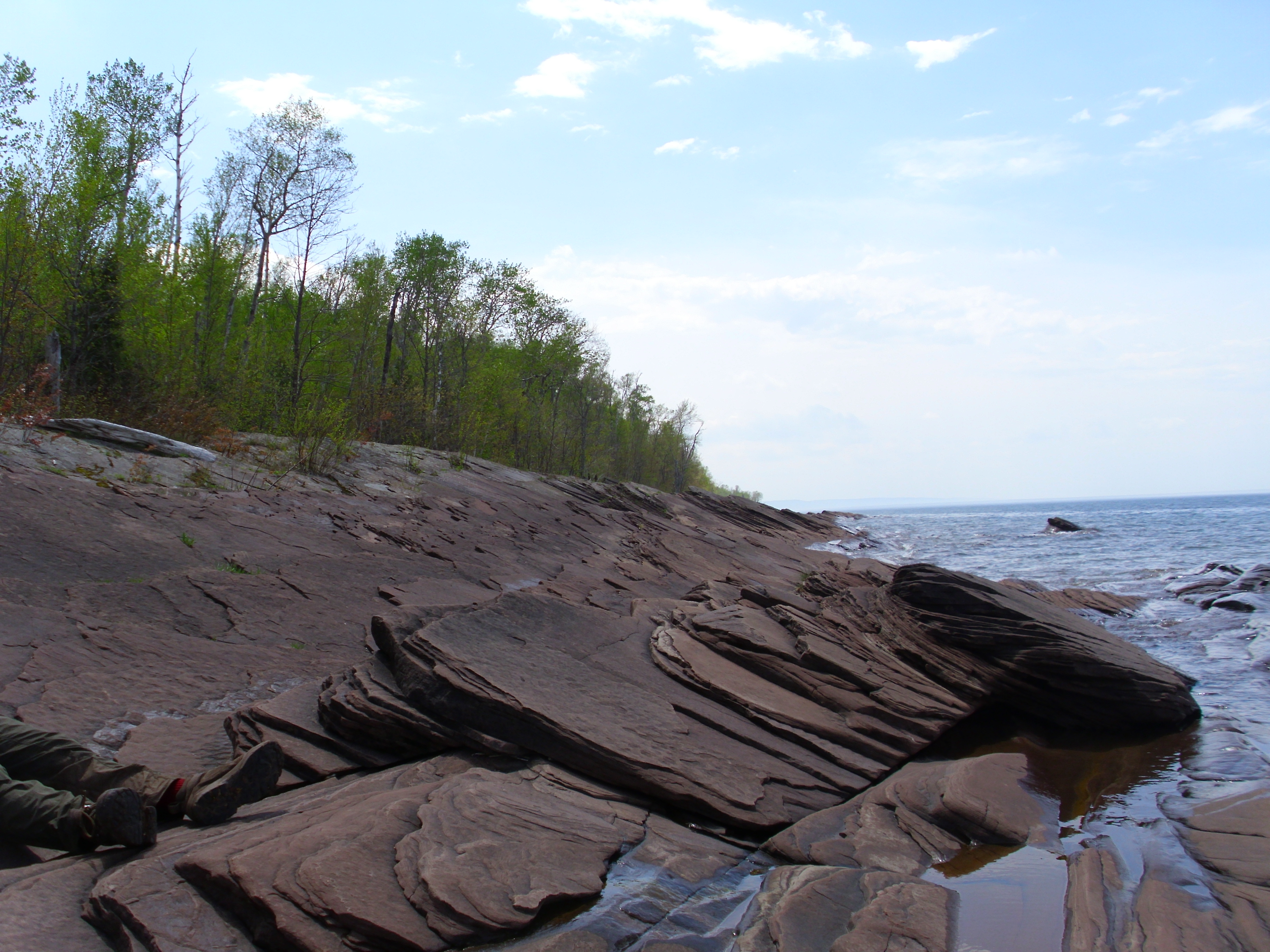
Lake Superior, Michigan
