Blog Archives

The Socially Distanced Cyclist: 16 Days, 1,170 Miles, and Minimal Human Contact Around the Coast of Lower Peninsula Michigan
From August 9 to 24, 2020, I took a solo, self-supported bicycle trip to explore the coastline of my home state, the great state of Michigan. Being the Great Lakes State and a water wonderland, Michigan offers 3,224 miles of freshwater coastline to explore as well as 124 lighthouses, both of which are the most of any state. The following is a summary the trip, encompassing 16 days, 1,170 miles, and following the coastline of Lake Michigan and Lake Huron around Michigan’s Lower Peninsula.
Approximate Route:

Day 1: Familiar Territory
Zeeland to Muskegon State Park: 67 Miles


It was a beautiful summer Sunday afternoon when I finally departed for my trip after a much longer than anticipated morning of final preparations. Bluebird skies and temps in the 80’s made it a day more fitting for a beach holiday than a long, sweaty bike ride. I would start the trip covering very familiar territory, a survey of the Lake Michigan beaches within just a short driving distance of where I grew up. I hopped on my overloaded bicycle and listened to the new squeaks and groans as the immense weight found its equilibrium on my old Cannondale, crossing my fingers that no spokes would snap (wanting to keep myself socially-distanced as possible, I chose to pack around 35 pounds of food so I wouldn’t need to re-provision the entire trip). My first leg would be the twelve mile distance to the white sand beaches of Holland State Park, with a ceremonial stop to see my beloved ‘Big Red’ Lighthouse, which would mark the first of many lighthouses I would stop to see on the trip.
The Holland area boasts many wonderful non-motorized recreational paths, and I followed one of them along Lakeshore Drive, past many lakeshore mansions, nearly all the way to Grand Haven. Grand Haven State Park, another beautiful white sandy beach, was packed with beach revelers on such a gorgeous day. From Grand Haven, I crossed the drawbridge over the Grand River and proceeded northward to Muskegon. This first day of the trip was marked by getting through some of the bigger metropolitan areas on the lakeshore to the less developed lands of the northern counties. North of Muskegon lies Muskegon State Park, a much quieter and forested lakeshore dune park than both of the state parks I had visited earlier. It was at Muskegon State Park where I would first camp for the night, and, as an omen for a good trip to come, I found a $20 bill on the road leading to the park.
Day 2: Storm’s A-Brewing
Muskegon State Park to Ludington: 72 Miles


Day two started fairly leisurely on the sandy beaches of Muskegon State Park, followed by a stimulating up-and down ride through the tree-covered dunes to the Blockhouse, the highest point in the park which offers great views of the dune ecosystem. Continuing northward, I followed the aptly-named Scenic Drive paralleling the lakeshore until I reached White Lake and the twin villages of Whitehall and Montague. As recommended, I found the Hart-Montague Trail, which was Michigan’s first Linear State Park and one of the earliest instances of Rail-to-Trail conversions in Michigan (1991). The Hart-Montague Trail runs for 22 miles and connects several small country towns that offer ice creameries and small cafes. Being a former railway, the trail is undeniably flat and straight, with mostly shrubs and brush for scenery. A few miles shy of Hart, I got the itch to return to the lakeshore for more expansive scenery and some hills for interest. I turned west towards the lake and the sand-buggy enclave of Silver Lake. Though I yearned to make the short detour to the remarkable Little Sable Point Lighthouse in Silver Lake, dark ominous clouds had begun building to the west.
I followed roads along the lakeshore through the city of Pentwater and past the cottages of Bass Lake. A few miles south of Ludington, the road passes right by the Ludington Pumped Storage Plant, once the largest pumped storage plant in the world! During the night, when there is excess electricity generated, the plant will pump water from Lake Michigan up into a 1.3 square mile reservoir over 350 feet above the lake. Releasing this water during the day generates supplemental electricity during peak demand. I stopped to gawk at its massive industrial workings, until a security guard came and asked me to leave. The guard said they were shutting down the overlook due to impending weather and showed me the radar on her phone. Yikes! I made a mad bike dash down from the high dunes to the city of Ludington, where I fortunately was able to set up camp before the heaviest rains set it. It was an eventful night as lightning flashed and thunder cracked overhead, but this would prove to be the only rain encountered on the whole trip.
Day 3: This is Hilly Amazing!
Ludington to Sleeping Bear Dunes National Lakeshore: 78 Miles


The storms had passed during the night leaving me with wet gear, but a warm sunny day proved to be in order once again. North of Ludington, Hamlin Lake and Nordhouse Dunes (Lower Michigan’s only federally-designated wilderness area) block road access to the lakeshore, so I took an inland route of country roads through the matrix of forest and small farms. Riding into Manistee took me back to the lakeshore, and proved to be stop with plenty of great parks to relax at along the lakefront. A few miles north of Manistee, while riding on Lakeshore Road, I got caught up in paying too much attention to a car behind me as I looked to turn left towards the beach access. My front wheel slipped off the paved roadway immediately bogging down in the soft beach sand and causing a slow-motion flip over the handlebars. Aside from a few superficial scratches on my hands, knees, and bike, I was shaken, but OK.
I continued on, albeit more wary of soft shoulders now, around Portage Lake and the small town of Onekama. Onekama is the southern terminus of Michigan Highway 22 (or M-22), that famed route whose highway sign is emblazoned on merchandise and bumper stickers all over Michigan. Reaching M-22 proved a dramatic change in riding conditions; here, the hills began. Whereas up until now things had been remarkably flat, M-22 began a series of long, winding, gradual 1-to-2 mile climbs up a sand dune, followed by a speedy descent on the other side. I maxed my downhill speed out at 39 MPH, which on a fully-loaded bicycle is simultaneously exhilarating and terrifying. I broke up the hill climbs with stops at the little Victorian town of Arcadia’s city beach, and at the much more bustling tourist town of Frankfort. I then turned my route inland toward the town of Beulah, in search of cherry pie and wine. Riding from Frankfort along the sizable Crystal Lake proved no relief from the hills, and slower travel over the terrain caused me to miss out on the treats found in Beulah. Hungry and exhausted, I made my camp for the night just a few miles to the north in the Sleeping Bear Dunes National Lakeshore.
Day 4: I Bearly Got Anywhere Today
Sleeping Bear Dunes National Lakeshore: 37 Miles


However exhausted I was from the hill climbs the day before, I woke up very excited for the route I would cover today. I would be traveling through the Sleeping Bear Dunes National Lakeshore, perhaps the most scenic stretch of land in the Lower Peninsula (indeed, Sleeping Bear was named ‘The Most Beautiful Place in America’ by ABC’s Good Morning America in 2011). My bike, however, seemed less up for the challenge. As I had feared, all the popping and groaning coming from my crank were signs that my bearings were going bad, and my crank assembly had been growing disconcertingly looser and looser since day two. I would need to make a pit-stop to have that taken care of before I found myself stranded with no pedals to pedal.
I followed the quiet stretch of M-22 into the tourist outpost of Empire, where I met up with the Sleeping Bear Dunes Heritage Trail. This trail winds through the woods through most of the park, providing most excellent riding scenery. The trail also goes over some very steep dune sections and around some very sharp curves which makes for a sendy route to keep riders on their toes. Highly recommended is the Pierce-Stocking Scenic Drive, which winds a course of seven miles over some of the biggest dunes in the park and past some of the best vistas of Lake Michigan on top of the 400-foot tall sand dunes. Unfortunately for me, and maybe fortunately for my bike, the Pierce-Stocking drive was closed in 2020 due to road construction. However, a short distance north is the epic ‘Dune Climb’, a large active dune blowout that guests are encouraged to climb. The vantages from the top are quite spectacular, and offer sweeping vistas of Lake Michigan, the dune systems, and the valleys inland. Sleeping Bear Dunes also offers opportunities for history hounds as well. Just north of the dune climb is Glen Haven, a former fishing company town that the National Park Service now maintains as a historic village. Tucked in pockets around the park are also the barns and farmhouses of homesteaders of yore. In the course of time, most homesteads folded in the region, and the main economic driver switched to tourism.
I finally stopped to have my bike repaired in Glen Arbor, and the mandatory afternoon of downtime was well spent enjoying a swim in the crystal blue waters of Lake Michigan, as well as doing some tourist shopping in Glen Arbor itself. Not a big day distance-wise, but one of the best places just to enjoy some time in the splendid destination.
Day 5: Up and Down on Leelenau
Leland to Traverse City: 84 Miles


Back in 2012, I had taken a short bike vacation with my parents to the Leelenau Peninsula, and this area offers so much for the bicycle tourist on shorter trips as well as longer ones. The bigger towns of Leland, Northport, and Suttons Bay all offer their own vibe and tourist amenities. I started my day by following M-22 into Leland, of which any stop requires a mandatory visit to the historic and artsy Fishtown. A pleasant and lightly-trafficked ride north on M-22 took me to the quiet town of Northport. About an 8 mile ride north of Northport, past many cherry orchards, I reached the very tip of the Leelenau Peninsula which is home to a state park and the impressive Grand Traverse Lighthouse. The lighthouse was open to tours, though the tower was closed due to COVID.
On my way south on M-22 towards Suttons Bay, just past Omena, I crossed over the 45th Parallel (I had actually crossed over it earlier in the day between Leland and Northport), which, being the geography nerd that I am, necessitated a reason to celebrate. The closer I got to Suttons Bay, the more traffic M-22 picked up, and the worse shape the road became. Though riding M-22 next to Grand Traverse Bay was scenic, I was happy to beat the traffic by picking up the TART Trail (Traverse Area Recreation and Transportation Trail) going into Traverse City. Being the ‘Cherry Capital of the World,’ I biked past many cherry and fruit orchards on my way into the city.
Day 6: On a Mission
Old Mission Peninsula to Charlevoix: 78 Miles


The start of the day would take me onto the Old Mission Peninsula, the very long and narrow stretch of land that neatly divides Grand Traverse Bay in two. I peddled up the Peninsula on the west side’s Peninsula Drive, which offers a very quick and flat route to the tip, going past miles of miles of really fancy waterfront properties along the way. At the tip of the Old Mission Peninsula lies the Mission Point Lighthouse and a nice beach with crystal clear waters. The route back to Traverse City, along the main highway M-37, offered quite a contrast to the solitude and ease of Peninsula Drive. M-37 goes through the middle of the Peninsula, meaning the road goes up and down many hills as it winds its way mostly through vineyards. Though the hills were challenging, they did provide some incredible vistas of vineyards and Grand Traverse Bay. Had it not been before 10AM, I would have stopped for a tasting.
Once back into Traverse City, I caught the TART Trail to its eastern terminus in Acme, a few miles away. I was glad to avoid the heavy development and tourist traffic along that stretch of US-31. Once the path ended, I followed the signed bike route through some bucolic country acres until I ended up at US-31 again. During route planning, I had wanted to bike that stretch of US-31 as it passes on a narrow strip of land between Lake Michigan and both Elk Lake and Torch Lakes. In hindsight, this was the only section of my route that I wish I had changed. US-31 along that stretch has only a narrow, crumbling shoulder, and the summer tourist car traffic is constant. Even worse, the route has absolutely no views of any lake along the way. As a plus side, though, the heavy tourist traffic does bring with it an abundance of roadside food, fruit, and sweet stands, and Elk Rapids makes a nice town to stop at. Given that it was an exasperatingly hot and sunny day, I made my fill of stops along the way to replenish my belly and refill my electrolytes with some pasties, pastries, and apple cider.
Day 7: Through the Tunnel of Trees
Charlevoix to Cross Village: 81 Miles


Whereas the previous two days were spent biking around the Grand Traverse Bay, today I would bike around the Little Traverse Bay. First stop of the day was in the harbor town of Charlevoix, outside of which I picked up the Little Traverse Wheelway bike path. With the underlying bedrock of the region being limestone here, I made several lengthy stops along the lakeshore to try my hand at fossil hunting. Being so close to Petoskey, I was really hoping to find a stellar specimen of the city’s namesake and Michigan’s state rock (even though Petoskey stones are indeed a fossil, they are not Michigan’s state fossil). Alas, good specimens of Hexagonaria coral (AKA Petoskey stones) were difficult to find, but it doesn’t take an expert paleontologist to soon pick out many other fossils in the mix; fossilized horn corals, bivalves, brachiopods, and crinoids all make the lakeshore a Devonian paleontologist’s playground. Following the nicely-paved Wheelway around Little Traverse Bay will take you to the towns of Petoskey and Harbor Springs, both of which offer plenty of dining and shopping amenities. Petoskey offers a large historic downtown area built into a hillside, whereas Harbor Springs caters to the yacht club upper-crust.
Past Harbor Springs, following Michigan Highway 119 (M-119) is both the motorist and cyclist eye-candy route known as the ‘Tunnel of Trees’. The Tunnel of Trees is a splendid, curvy, 1 1/2 lane highway that encourages you to slow down and enjoy being immersed in the trees as the highway meanders along a sand dune bluff for nearly 20 miles. Traveling, as I was, on a mostly cloudy evening, I encountered very little auto traffic (I let my eyes wander once again, forgetting entirely my days-earlier episode of crashing my bike). At the northern end of the Tunnel of Trees is the tiny settlement of Cross Village, most notably known for its iconic roadhouse, the Legs Inn. In the 1930’s Polish immigrant Stanley Smolak, along with the help of local Odawa craftsmen, began to build the fantastical building using local stone and driftwood. It is highly recommended as a place to eat, or at least walk in and feast your eyes on the décor. Wait times often exceed one hour. Though a hot meal and a beer sounded nice after such a long day, I was burning daylight and had to get to my campsite near Wilderness State Park.
Day 8: In the Straits, not in dire straits
Wilderness State Park to Mackinac Island: 45 Miles


Wilderness State Park is a fantastic, remote expanse of land on the northwest tip of lower Michigan. It offers wide swathes of pine forest and vast expanses of sand dunes, and is highly recommended to spend a full day there. My time in Wilderness State Park would prove eventful. I had just started biking for the day when I came around a corner and saw two young men frantically waving for me. I caught glimpse of a motorcycle stuck under a truck, which is what they were making a big fuss about. I stopped to help the two guys, both named Tyler, incidentally, to get the motorcycle out from under the truck. By that time, I had already pieced together the narrative that the man with the fresh patches of road rash had lost control of his motorcycle going around the curve, and had slid under the parked truck. Fortunately everyone was OK, and I helped Tyler clean up his road rash a bit. Of the three of us there, only my flip phone had cell service, and I stayed with them until they arranged a tow. Flip phone for the win!
Since I no longer had time to explore the vastness of Wilderness State Park, I picked my way along rough rural roads in Emmet County towards the very tip of the Mitt at Mackinaw City. Along the way, however, I couldn’t resist stopping when I saw a sign for the McGulpin Point Lighthouse (which, by the way, you could actually climb the tower). From the McGulpin Point light tower, I could get a great view of the Mackinac Bridge spanning the Straits of Mackinaw. I was at the tip of the peninsula, but the Mackinac was a bridge I would not cross (at least not on this trip). Nearby the lighthouse is the Headlands International Dark Sky Park, and the region is perfect for stargazing on a clear night.
Now that I was halfway through my ride and at the tip of the Peninsula, my crowning stop would be an afternoon spent on Mackinac Island, Michigan’s iconic and premier island destination. A former British fort and a tourist destination since the mid-1800’s, Mackinac Island was once even briefly a federal National Park (1875-1895). Today, the island is known for its bikes and horse-drawn carriages, its Victorian architecture, its fudge and tourist shops, and for being carless. It is a half-hour ferry ride to the island from Mackinaw City, and to get to the ferry terminal you have to pass through all the shops of downtown Mackinaw City that are hawking fudge and T-shirts. Once you land on Mackinac Island itself, you’ll be in downtown and will walk past all the shops hawking the same fudge and T-shirts as the mainland. But when you’re on the island, it’s special, and I did the touristy thing of buying fudge, popcorn, and postcards. The island is also great for history buffs, given Fort Michilimackinac and other historic buildings to tour, but I was there for the bike riding. A right of passage on the island is to bike the 8 mile loop on M-185 that rings the island. I had biked around the island once before on a family trip when I was in fifth grade, but biking on my own as an adult was so much better. Of course I had to make a stop at some of the iconic geological formations such as Arch Rock and Skull Cave. And there was no better way to cap off the day than by getting ice cream from the shop below the Grand Hotel’s world-record 660′ long front porch.
Day 9: Lonesome Limestone Highway
Mackinaw City to Thompson’s Harbor State Park: 74 Miles


United States Highway 23 offers a dramatic contrast to the commercialism of Mackinaw City. Never before had I been to northeast Lower Michigan. It is an region of small towns separated by large distances all built on the extractive industries. From Mackinaw City to Cheboygan, the North Central State Trail follows an old railroad grade paralleling Highway 23. Though the crushed gravel of the state trail was nice, I found I preferred the feel of pavement and the glimpses of Lake Huron that riding on the road afforded me. Traffic was light and the shoulders were wide, which meant great riding conditions.
The surrounding waters of Lake Huron are extremely treacherous, and have claimed hundreds of ships and lives over the centuries. These shipwrecks are all protected within the Thunder Bay National Marine Sanctuary. Forty miles from the Straits of Mackinac is the Forty Mile Point Lighthouse. Several shipwrecks lie in shallow water just offshore, but the remains of the 1905 wreck of the J.S. Fay lie on the beach near the lighthouse. Snorkeling, SCUBA diving, kayaking, or glass bottomed boat tours are all the best ways to see the wrecks.
From Forty Mile Point, one can get on the paved Huron-Sunrise Trail, which leads to Rogers City. Though Rogers City is small, its status as the only town of 1,000 or more people for 30 miles in either direction means that it has all the amenities a person would need. Rogers City is built on mining—mining the fossil-rich limestone bedrock that dominates the region. The limestone is crushed and used as an ingredient in cement, and Lake Huron provides easy access for shipping to distant markets. Outside the city is a special overlook that peers into the massive strip mine that gives Roger’s City its lifeblood. The Calcite Quarry, at over 1,800 acres, ships out 7 to 10 million tons of limestone each year.
Leaving Rogers City early in the evening, the sun was beginning to shine lower and lower on the horizon, while the blue open skies made the late sunshine feel quite tangible. I took a detour off of US-23 at Thompson’s Harbor State Park to search for the Presque Isle Lighthouses. Without directions or a detailed map, I followed an unnamed dirt road hoping it would take me to the lighthouses. The road dead ended at the outlet where water from Grand Lake flows into Lake Huron. The low gleaming sun, the slight warmth in the gentle breeze, the sound of the rocks rolling in the surf—it aligned all too perfectly. I had to stop right there for the day—I had to sit down and just bask in the beauty of the experience. If anything, that evening spent on the beach of Thompson’s Harbor was the defining spiritual experience of the trip. The video encapsulating my experience is included above.
Day 10: Here On Huron
Thompson’s Harbor State Park to Oscoda: 76 Miles
")


After my euphoric evening at Thompson’s Harbor State Park, I had to follow up with nothing short of a pre-breakfast swim in Lake Huron. My morning route would continue around Grand Lake to the small sleepy enclave of Presque Isle. I would find both the old and the new Presque Isle Lighthouses on a peninsula, and, not unexpectedly, both were closed for the summer. Nevertheless, taking the detour around Grand Lake to those small communities and idyllic harbors was well worth it. After passing another large limestone quarry, I reconnected to US-23 and had a short ride into the city of Alpena.
Alpena hails itself as the ‘Sanctuary of the Great Lakes’ owing to its location at the center of the Thunder Bay National Marine Sanctuary. It is a large city, as far as cities in northeastern Michigan go, and along with the extractive industries of fishing, lumbering, and limestone quarrying, Alpena boats a modest maritime tourist economy as well. Unfortunately the highly acclaimed NOAA Museum and adjoining glass-bottom boat tours were closed due to COVID. At this point in the trip, I had grown terribly tired of the food I had packed from home, so I stopped in downtown Alpena to get the greasiest cheeseburger Alpena could offer. While seated at the restaurant, a middle-aged couple started up a conversation by saying that they had seen me yesterday riding from Mackinaw City. We chatted a while about our Michigan travels, and they seemed thoroughly impressed by my stamina. They also paid for my meal.
I left Alpena headed south on US-23 on the mostly empty road past the endless forest. A peculiar place to stop would be Ossineke, where giant sculptures of Paul Bunyan and Babe the Blue Ox great travelers on the highway. Nearby, a gigantic Jesus holding the earth aloft in one hand beckons visitors to come visit the Dinosaur Gardens Prehistoric Zoo, an eclectic and anachronistic mix of cavemen, dinosaurs, and Christianity. By the time I was ready for a break, I was passing by the small town of Harrisville, and I saw a sign for an outdoor concert at the lakefront pavilion. It was some good foot-tapping folk music being played, and after a few songs an announcement was made that it was the organizer of the concert series birthday today. A homemade carrot cake was cut up to celebrate. I was invited by a women to grab a slice. What great small-town hospitality! South of Harrisville, US-23 travels right next to Lake Huron, on what is called the ‘Sunrise Coast’. In a long stretch from Harrisville to Oscoda, the lake is lined with second homes and vacation rentals. I think I finally found where most of the east-siders go on their summer vacations.
Day 11: To the Thumb Pit
Oscoda to Standish: 71 Miles


The twin villages of Au Sable and Oscoda mark the finish line of one of Michigan’s most epic races: The Au Sable Canoe Marathon. In the race, competitors start 120 miles upstream in Grayling, paddling through the night to reach the finish line near Lake Huron. The race was cancelled in 2020, but seeing so many fine rivers as I biked along the coast made me itch to get out and paddle again.
A short distance later, I would be coming upon the start of the ‘Thumb Pit,’ better known as Saginaw Bay. The Tawas Point Lighthouse marks the start of the bay on the northern end, and Tawas City is a small tourist enclave. Continuing south on US-23, the highway is flat and runs right along the lakeshore. The tourist resorts and second homes disappear, and the landscape consists of forest and utilitarian buildings. Maybe it was something about this road, or maybe it was because I just started to put my head down and ride, but I began to notice an abundance of quarters, nickels, and dimes scattered on the shoulder. Another roadside find was a ‘Don’t Tread On Me’ flag, which was evocative of the region’s independent and libertarian leanings.
Day 12: Thumbs Up
Standish to Port Austin: 77 Miles


Today I would round Saginaw Bay and enter Michigan’s Thumb. Pure geographical curiosity had me wondering what it would be like to visit, though I have heard that the Thumb is very flat, rural, and agricultural. The rumors proved true: the Thumb is incredibly flat, rural, and agricultural. Very small farm towns dot the landscape. Biking south on M-13 going into Bay City, I passed through Pinconning, Michigan’s Cheese Capital. On the Thumb, the town of Sebewaing has a large sugar beet processing plant. It was not until the very tip of the thumb, in the towns of Caseville and Port Austin, where vacation homes and tourist attractions began to sprout up along M-25 by the lakeshore. The thumb-tip also offers a couple of nice state parks with sandy swimming beaches.
Day 13: Last Day Along the Lake
Port Austin to Lakeport: 84 Miles


Starting from the tip of the Thumb, today would be my last day biking along the lakeshore as I made my way south on M-25 towards Port Huron. M-25 runs right along Lake Huron, passing many small towns along the way. Even though the route is right next to a Great Lake, it remains agricultural and undeveloped. I biked past the historical company town of Huron City and then past the Point Aux Barques Lighthouse and former U.S. Life Saving Service Station. I continued biking past many sleepy towns enjoyed by the R.V. crowd, until I passed through more touristy enclaves like Lexington and Lakeport as I neared Port Huron.
Day 14: Eastward
Lakeport to Flint: 96 Miles

Alas, all good things must come to an end, and I was about to wrap up my travels along the Great Lakes and start the long trek eastward back to my starting point in Zeeland. I couldn’t help but say goodbye to Lake Huron with one final swim at Lakeport State Park. From Lakeport I would pedal eastward through the farm country in the heart of the state. I passed through small towns named Yale, Lynn, Capac, and Dryden. The roads were rough and had limited shoulder, and I bet that road bikers are a rare occurrence there. However, even with the unseemingly busy roads and all the trucks trying to get past me, every driver was courteous. By the time I biked to Metamora and Hadley, the farmland had turned to hills and forest. I would end the evening on the outskirts of Flint, after a very long, hot and sunny day.
Days 15 & 16: Wrapping Up
Flint to Middleville to Zeeland: 115 & 35 Miles

One final, scorching hot day was ahead of me as I aimed to make it to my friends Robert and Becky’s house in Middleville for the evening. From the outskirts of Flint, I was immediately back into farm country. I would pass through Durand, home of the Michigan Railroad Historical Museum. I would also pass through Laingsburg, where I began running into fleets of spandexed cyclists out for a Sunday morning ride. Out of Laingsburg, I would follow country roads that ran along the crisp and cool Looking Glass River, being thankful for the trees lining the road that provided some measure of relief from the sun. Once past the outskirts of Lansing, it was all sun-beaten farmland until Middleville. Wanting to avoid traffic, I wandered down country roads, meandering generally East and South towards my destination. While I succeeded in avoiding traffic, I also never ran into the gas station that I had optimistically been counting on to replenish my desperately low electrolytes. By the time I arrived at Robert and Becky’s house, it was well past sunset. An incredibly long day, but one the prospect of seeing old friends again had motivated me on towards.
From Middleville, it was a chip shot of a day to finish the remainder of the trip back to Zeeland. More meandering and country roads, and the unanticipated stretch of country gravel, but 35 miles later I had made the trip complete.

Coronavirus Can Collecting

Typical Roadside Litter
A pastime that I share with my father we both affectionately call ‘canning.’ Essentially, the process of canning means either taking a walk or cruising country roads by bicycle looking to collect returnable bottles and cans strewn along a roadside. The benefits of canning are two-fold in that it provides an incentive for outdoors exercise while it simultaneously cleans up the streets of litter. And, thanks to Michigan’s bottle bill, there is a financial incentive to canning as well, which puts a refundable 10-cent deposit on all beer and soda cans and bottles. Though ten cents for a single can may not seem like very much, over the course of an outing it does add up.
With concerns over transmission of the Coronavirus, Michigan’s Governor Gretchen Whitmer ordered all bottle redemption centers closed starting March 24. Automatic bottle returns were not mandated to reopen until June 15, after it was determined that recycling is not a primary driver of disease transmission (in fact, the most dangerous thing you can take into a grocery store during a pandemic is yourself). In the 82 days that Michigan bottle returns were closed, it was estimated that Michiganders collected over $80,000,000 in unredeemed bottle deposits, as the number of unredeemed containers grew by an estimated $7,000,000 each week. At ten cents a pop for a can, that means at one point Michiganders’ had over 800 million cans sitting in their basements and garages! The sheer number of containers alone is staggering, but as a grocery store employee it comes as no surprise as daily I see the overwhelming capacity of beer and soft drinks that are bought and continuously restocked.
Anticipating the impending closure of the bottle returns, I deposited my final pre-closure collection of cans on March 23, just in time for the shutdown. I redeemed a modest sum, a little over $20, which is typical for just a couple weeks of collecting. This meant that during the Coronavirus shutdown, my dad and I would have a fresh start for can collecting so we could visually see just how many cans would pile up on our collection outings during the closure. Even though most grocery store bottle returns had reopened by June 15, the vast number of unredeemed containers created a nightmarish bottle-return backlog. It was not until much later that I finally redeemed all the cans we had collected during the shutdown, mostly due to waiting out the Black Friday-esque rush to redeem cans in the weeks following reopening, coupled with a $25 daily limit on redemption slips. Not to mention that the sheer number of cans I collected would not have even fit in my car (unfortunately, I neglected to take even a single picture of the epic bounty!).

- Not my cans in particular, but you get the idea
It was not until July 8 that I had finally finished returning my three-ish huge garbage bags full of cans. That totals 107 days of collecting. Total value of redemption: $156.20. That equates to 1,562 cans and bottles total! (not to mention all the cans and bottles not redeemed for cash because they were either not acceptable brands or they were too mangled to be accepted by the machine. So this estimate will ultimately be on the low end!).
If we analyze this on a per day basis, this number comes out to nearly 15 cans per day! (14.6 cans to be precise).
Of course, my household did generate some of the cans in our collection. If we subtract our portion of the cans, with a simple estimate of 2 cans per household member per week (we don’t drink a lot of beer or pop), we end up with (15 weeks x 3 people x 2 cans/week/person) = 90 cans, or $9. Not a significant percentage of the bounty (6 percent).
So, excluding my household’s cans leaves 1,472 bottles and cans that were scattered by the roadside, strewn across parking lots, or generally improperly disposed of. In terms of the environment, this is 1,472 pieces of easily recyclable material that instead ended up as unwanted litter!
Michigan’s bottle bill, passed in 1976, put a ten-cent deposit on non-reusable beverage containers. Similar to other environmental legislation of the 1970’s, Michigan’s bottle bill was aimed at reducing trash pollution, conserving natural resources, and increasing the rate of recycling. Among the ten states that currently have bottle bills, Michigan has long had the highest deposit price (being joined only in 2018 after Oregon increased their deposit to ten cents as well). With that higher deposit comes the highest rate of container recapturing: prior to 2018, each year the bottle bill was implemented saw over 90% of beverage containers redeemed. It could be argued that the current trend of falling redemption rates is due to inflation decreasing the value of beverage container refunds; in 2020 dollars, the ten cents paid in 1976, the year the bill was enacted, would be worth about 45 cents today. Perhaps it is time to raise the required deposit to keep up with inflation.
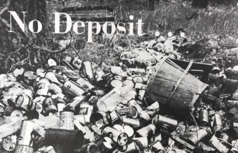
- Scenes like these from the 1970’s inspired Michigan’s 1976 bottle bill
Though Michigan’s recycling rate has fallen slightly as of late, we still lead the nation in terms of container recycling. Unfortunately our national recycling rate is at a disappointing 34.5%, which lags behind many other developed countries. Other states have had trouble passing bottle bills of their own, even though they face substantial litter problems. Tennessee, for example, had bottle bills die in legislation in both 2009 and 2010, even though recycling rates in the state are an abysmal 10 percent and discarded bottles and cans make up the majority of roadside litter. Indeed, the Container Recycling Institute says that beverage containers account for between 40-60% of litter. More states might enact bottle return bills if it wasn’t for the powerful lobbying interests of the can and beverage manufacturers who spend hefty sums to fight such legislation.
So we’ve seen that the ten-cent container deposit in Michigan really does boost recycling rates. But what happens to the deposits on the containers that are never returned? Remember, Michiganders place deposits on approximately 70 million cans each week. Where do the deposits from the 10 percent of containers that are never returned go?
Unredeemed funds from bottle deposits are called escheat funds, and these monies revert to the state. Twenty-five percent of escheat funds go towards retailers to defray the costs of operating bottle redemption sites. The remaining 75 percent of escheat funds goes towards environmental protection measures, which include site-specific environmental clean-up (80%), educational programming on pollution prevention (10%), and deposits into the Cleanup and Redevelopment Trust Fund (10%). The Michigan bottle bill generates around six million dollars each year in escheat funds for the environment.
So every time that you purchase a bottle of beer in Michigan, maybe you should stop and appreciate that the ten cents tacked on to your receipt is helping Michigan’s environment. Not only has the bottle bill increased recycling and decreased litter, it also generates funding for environmental cleanup that is paid for (in large part) by people who litter. Though, as evidenced from the falling rate of container redemption in Michigan, and from my recent collection of 1,472 littered cans, there is still a lot of improvement to do. Michigan could further incentivize recycling by increasing the amount of the required bottle deposit. To combat the abundance of single-use plastic water bottles thrown away, Michigan could consider joining states like Connecticut, Hawaii, Maine, New York, and Oregon that require a deposit on bottled water containers. And another common roadside polluter is liquor bottles; liquor is not included in Michigan’s bottle bill, but liquor containers have a 15-cent deposit in the states of Maine and Vermont. Until society reaches a point where there is no more litter and we recycle purely because it is the right thing to do, my dad and I will continue to enjoy the 10-cent per bottle perk every time we go pick up litter off the roadside.
freshavacado

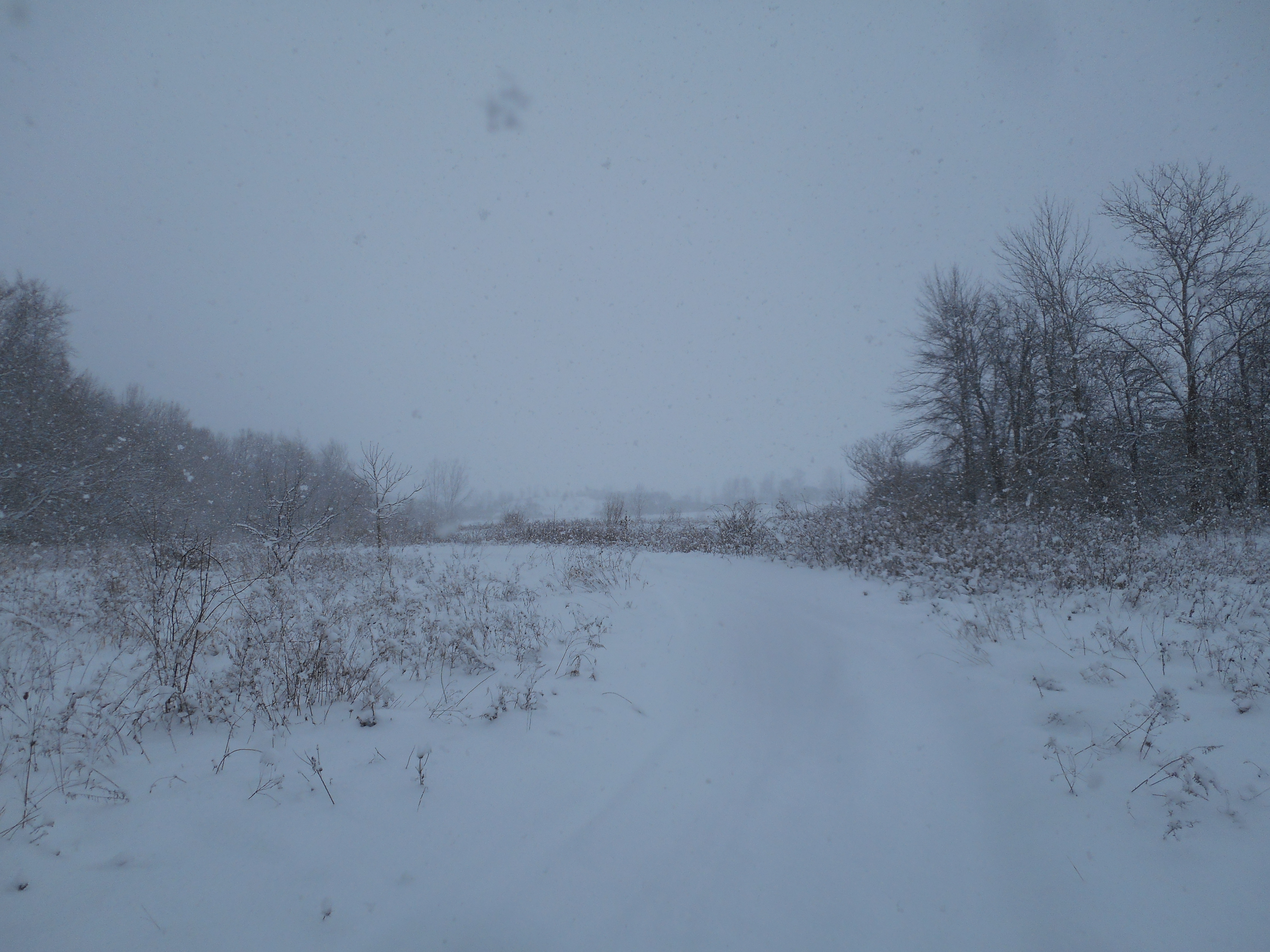
Winter Solstice

The land is quiet. The world is asleep. All around is still. No sound is heard save the lightly landing snow.
These are the short days of winter. Today is the darkest hour. The solstice is upon us; astrological winter has begun.
The world already knows the changes that have come. Plants lie dormant in the fields. Skeletons of last year’s growth remain as wind-battered sentinels above the white covering, an indicator of what species grew here in the warmer months. The animals, too, are hidden away; no tracks can be seen in the freshly fallen powder. Even the humans do not frequent these parts. The lone explorer presses along on skis, leaving behind an incriminating trail.

The winter sun vies for even a brief appearance through the clouds from its home low on the horizon. At these latitudes, it does not promise to linger long, if it even comes at all. Nevertheless, the fresh blanket of white reflects what little sunshine penetrates through the overcast skies. Beneath a firmament of gray, the land shines brilliantly bright. Such brilliance comes at the cost of the absorption of solar energy; the positive feedback cycle of winter cold is nearing its zenith, not to be broken until the sun shines more directly overhead once again.
Today the air is frigid. The illimitable cold turns the flakes falling from the sky light and airy. Super-frozen, they land delicately on the ground in a cottony pile. The lightest motion stirs up the powder like a coating of fine dust. Pick some up in your hand; you can blow the crystals of frozen water cleanly away. Taste some of the snowflakes; they melt instantly in your mouth.
Everywhere, the snow piles up. On tree branches, the fresh flakes land on top of one another in an acrobatic perch. The mere gravitational weight of the snowflakes causes them to deform, slowly melding the flakes together into a structural form. The smooth coating of white on everything makes the world look soft and inviting—comically rotund, perhaps—and radiantly white. How long has it been since movement disturbed these branches?

Though it is well below freezing, the small stream in the field remains unfrozen. The energy inherent in the motion of the water keeps the stream from solidifying, though snow flows in the water and ice nips at the edges. This creeping ice foreshadows the inevitable reach of the cold. It too, wants to cover over the stream, to cease even the motion of the water. For now, the water still flows. Water, in every state, is still flowing.
Nearby a chickadee flits around in the bushes. Now clothed in tones of dull gray, this year-round inhabitant matches the pale hue of the surrounding woods. The chickadee braces for the cold dark days of winter. It must vigilantly search for the stashes of seeds it has cached in the summer. Inactivity can quickly lead to a songbird’s demise.
The chickadee flies away just as quickly as it came. The world is once again still. No moving dares disrupt the hushed world. It is a time of waiting. Winter is here.